Greg Westrich

Indian Pond by Greg Westrich

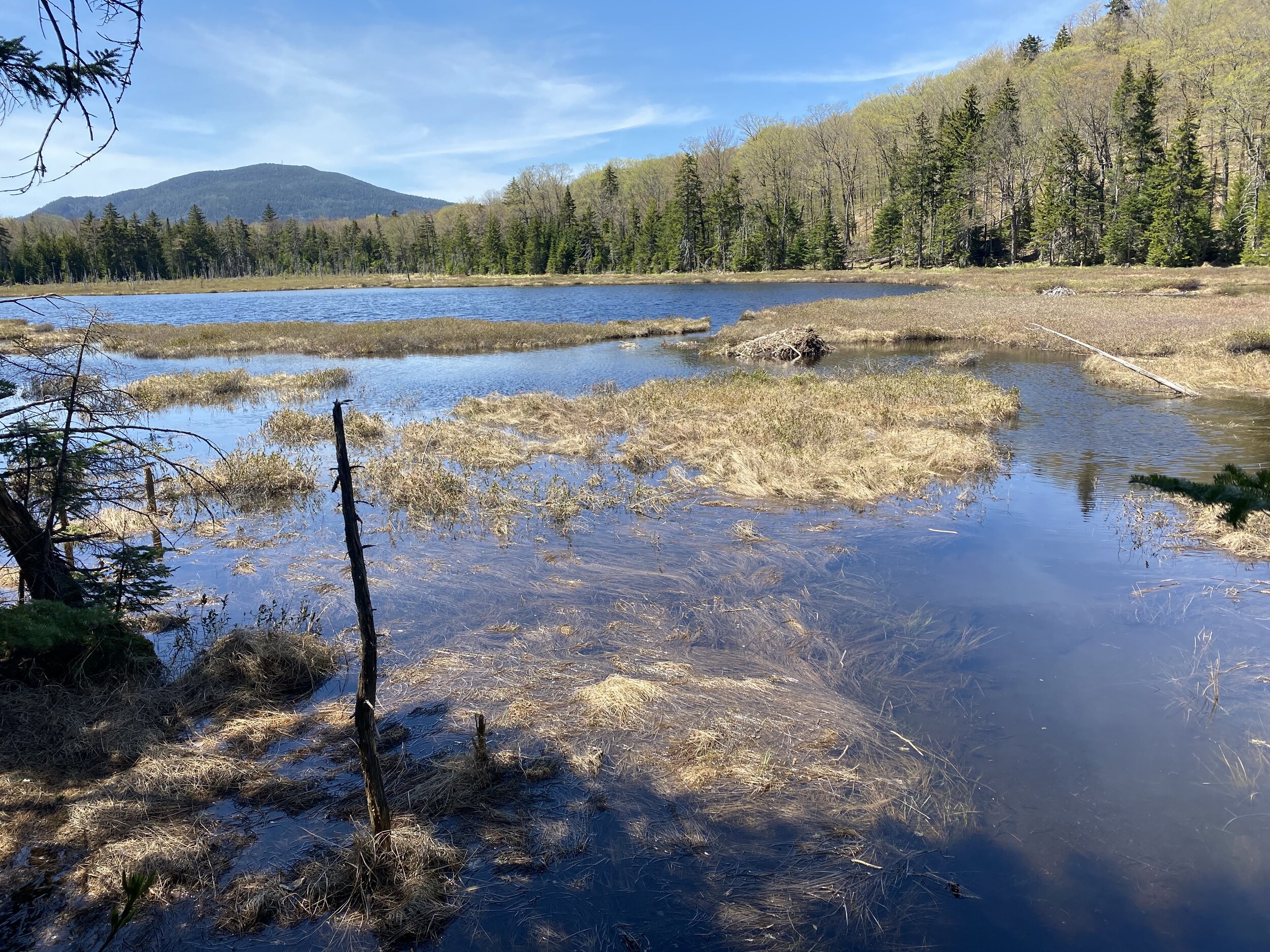
The east end of Indian Pond

Indian Pond is a remote and little visited lake at the southern end of AMC’s preserve in the Moosehead area. The hike is a 7.4 miles out and back with 1678 feet of climbing. The hike starts at the Third Mountain Trailhead along Chairback Road on the hill above Long Pond. You hike up to the Appalachian Trail, then descend the south side of the ridge and cross the valley to Indian Pond. The hike ends at the campsite on the shore of the lake.

As you can see from my photos, I did this hike before it snowed. But this is a good hike to do in the winter if you like breaking trail.

You can get to the trailhead from either Greenville or Brownville on the KI Road. Chairback Road leaves KI Road to the south at a point 1.0 mile west of the Gulf Hagas parking area. There’s a sign for Gorham Lodge at the intersection. Once on Chairback Road, drive 2.0 miles, passing the Henderson Brook trailhead and the turn for Gorham Lodge. Just past the Third Mountain Trailhead, there’s a parking area on the left.

The trailhead

The hike:

0.0 Third Mountain Trailhead.

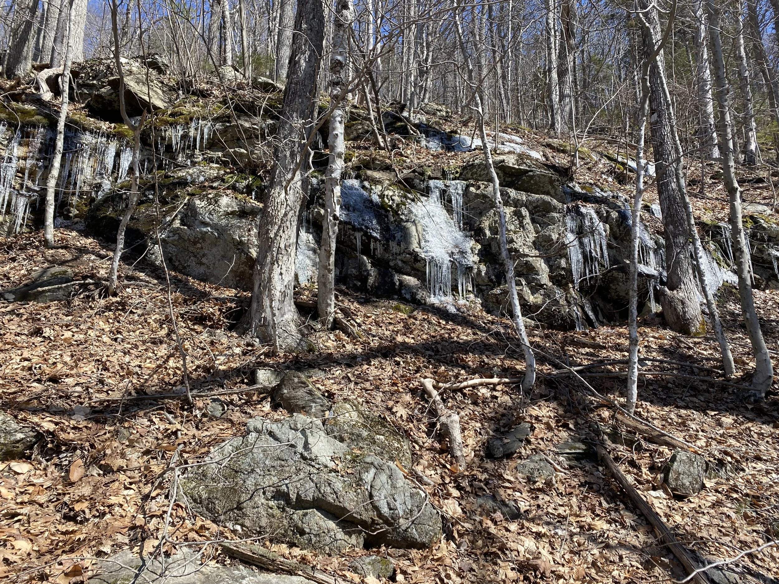
0.9 Climb gently through a hardwood forest along a brook. Pass Gorham Loop Trail (a xc ski trail that loops back to the lodge).

nearing the AT on the climb

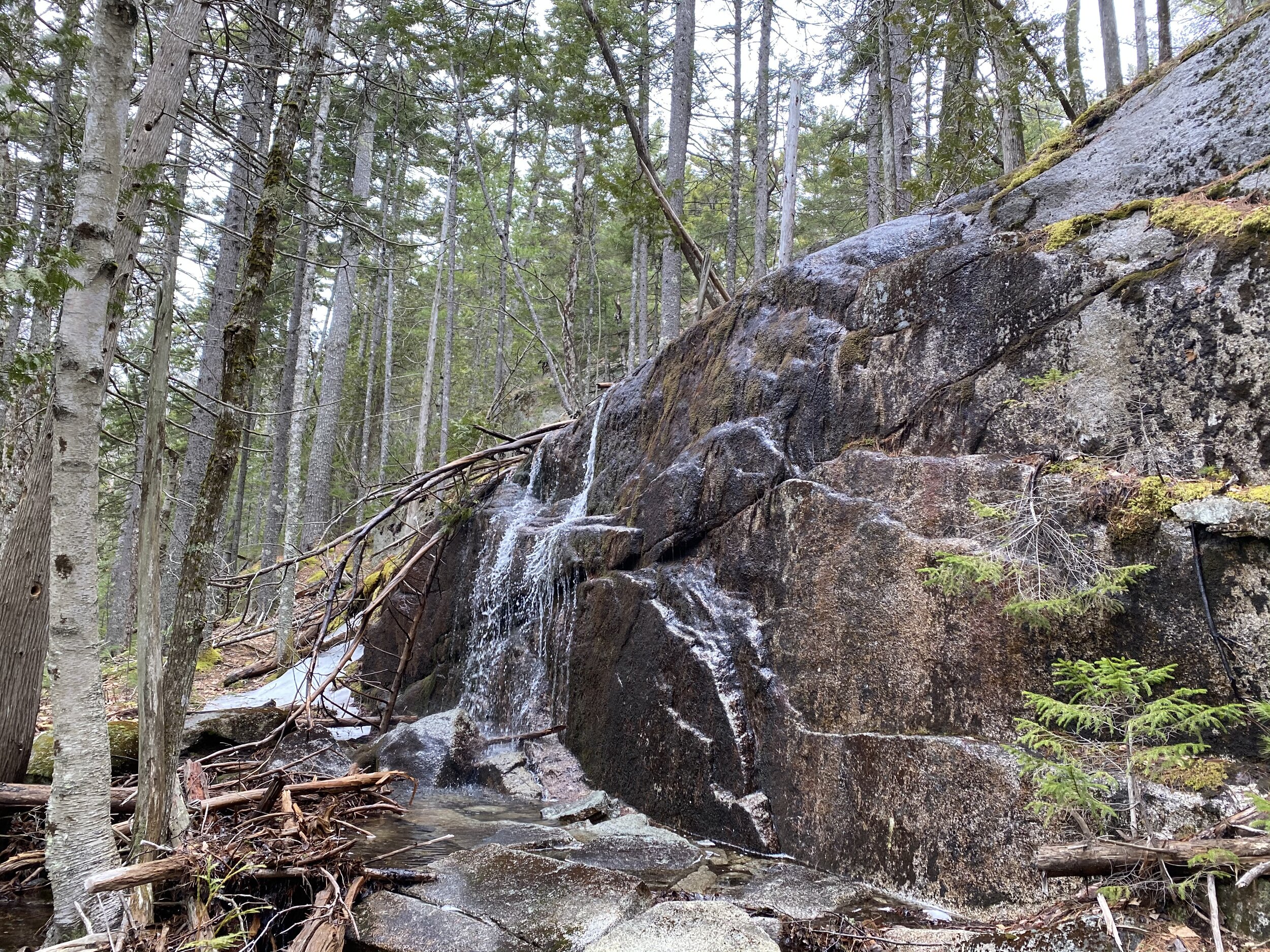
1.4 Switchback steadily up the ridge, including one ladder. The forest transitions from hardwoods to evergreens as the mountainside steepens. You cross the brook near its headwaters. The trail reaches the Appalachian Trail in the saddle between Third and Fourth Mountains.

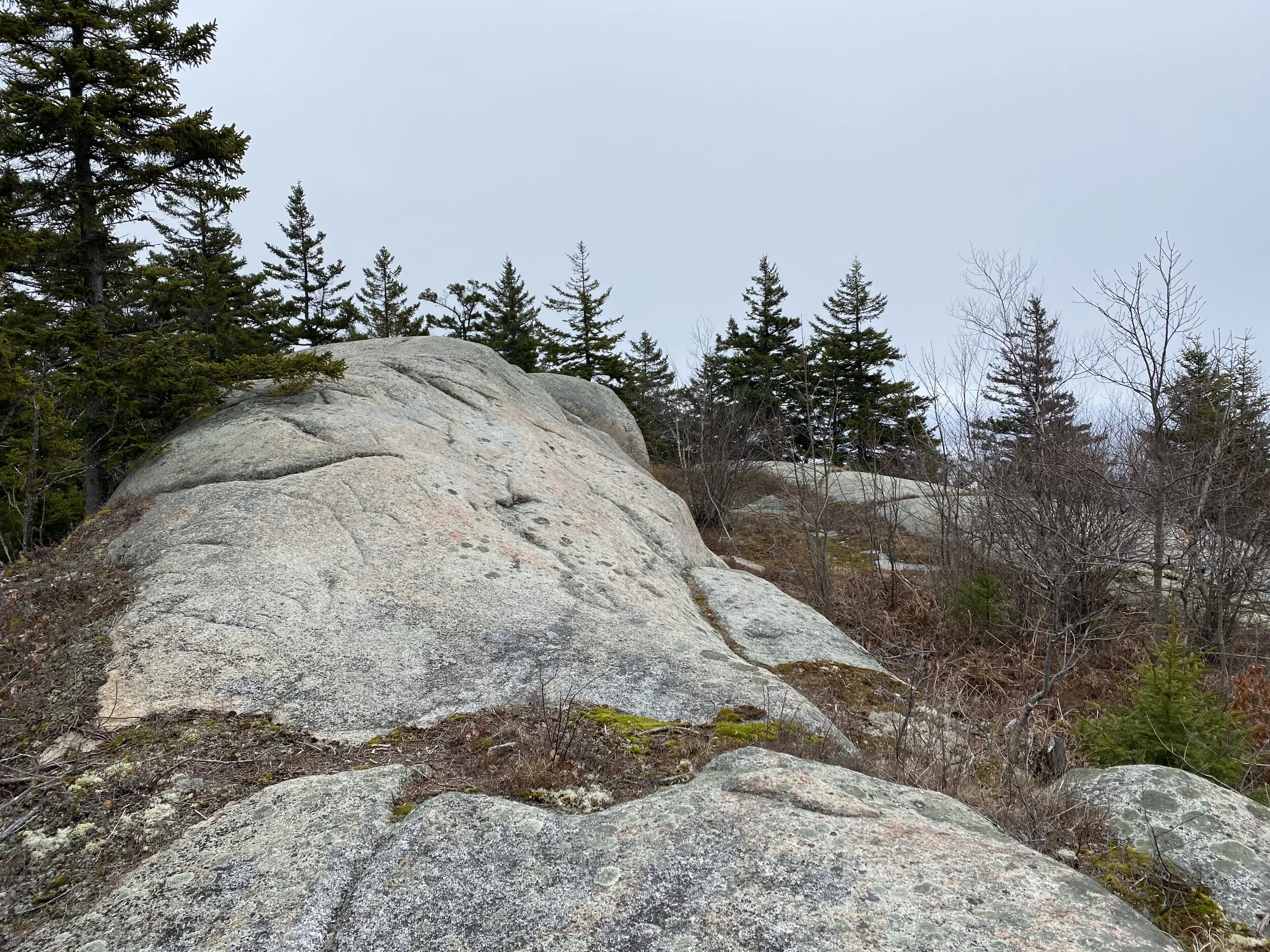
1.5 Cross the AT and climb steeply to the crown of the ridge.

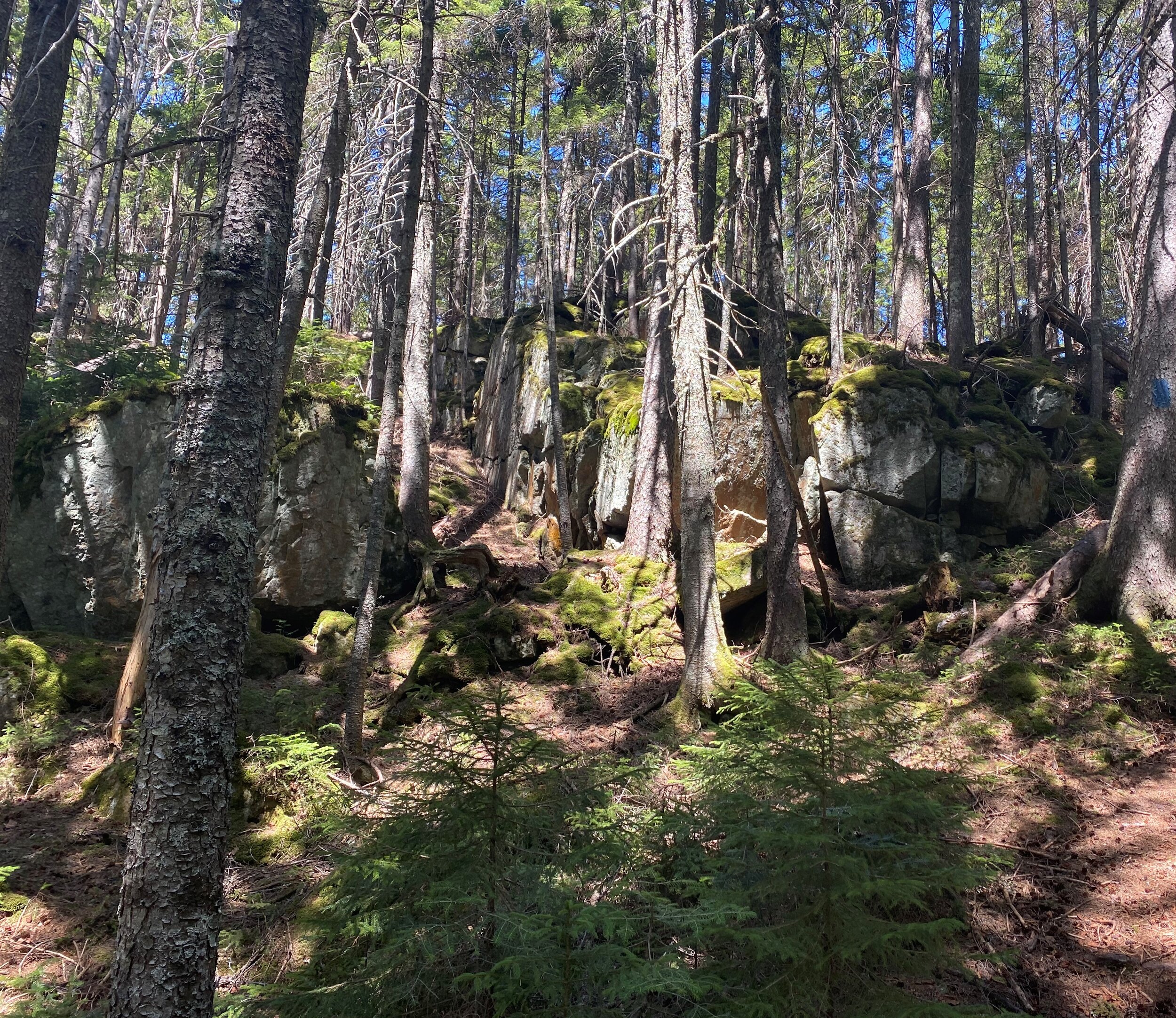
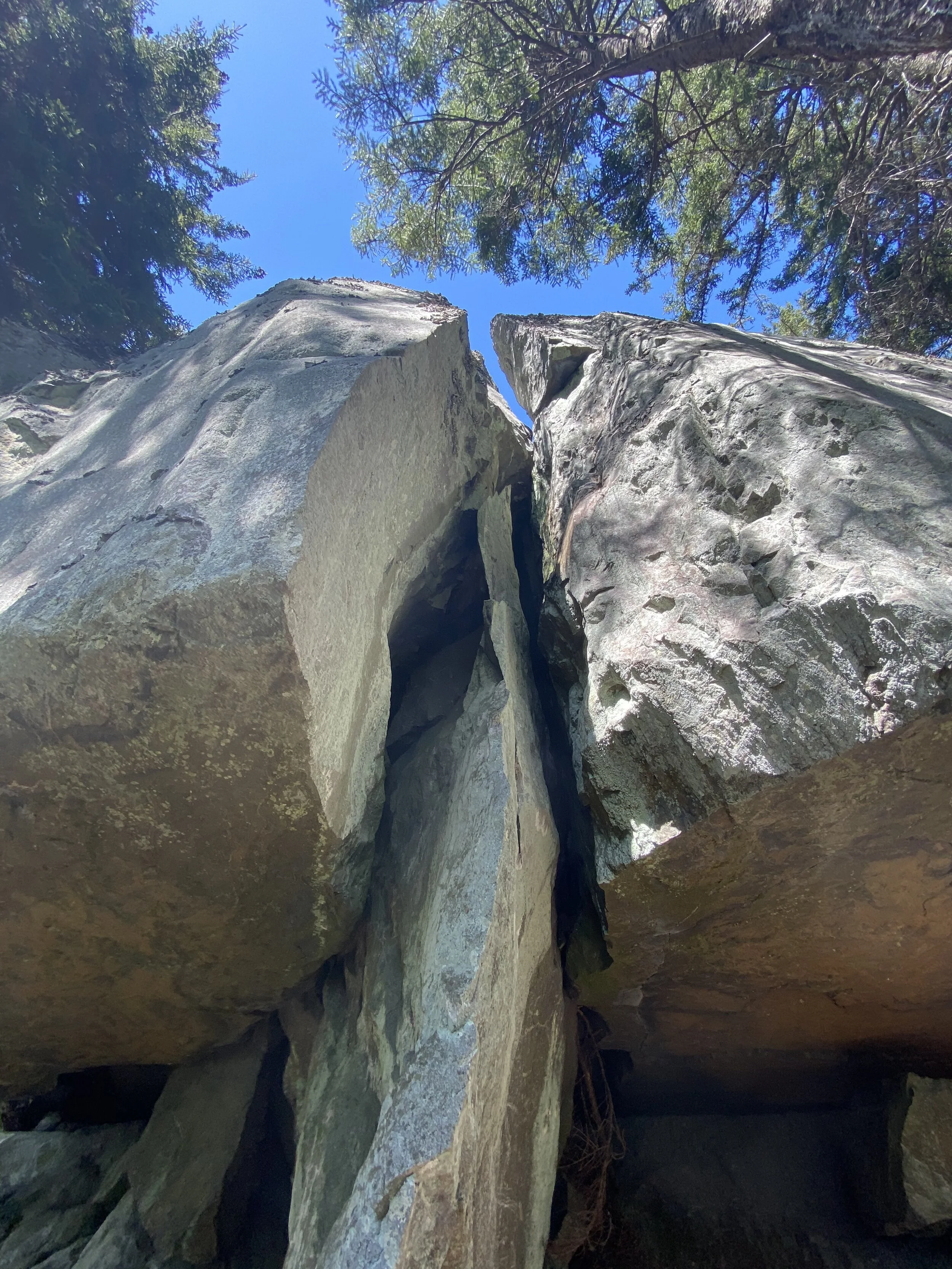
1.7 Descend through a hanging bog, across ledges, then more steeping through a rocky area with water flowing beneath the boulders to a small slide. From the slide you have a partial view to the south.
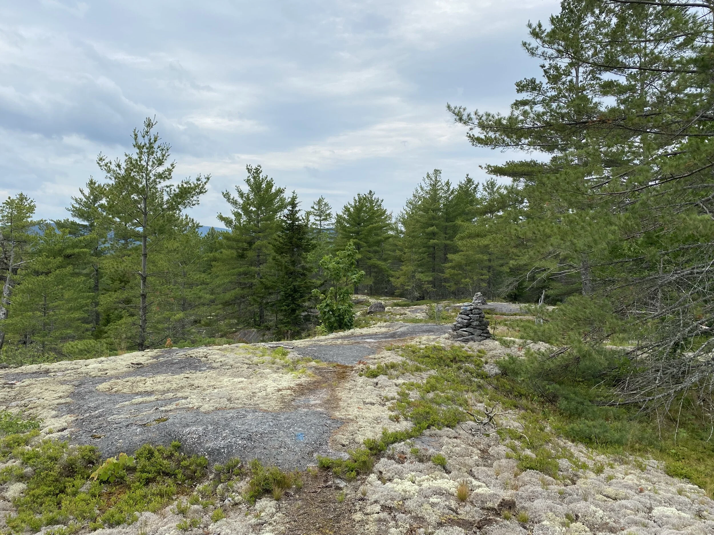
The bog in summer

Where the bog transitions to the bouldery descent

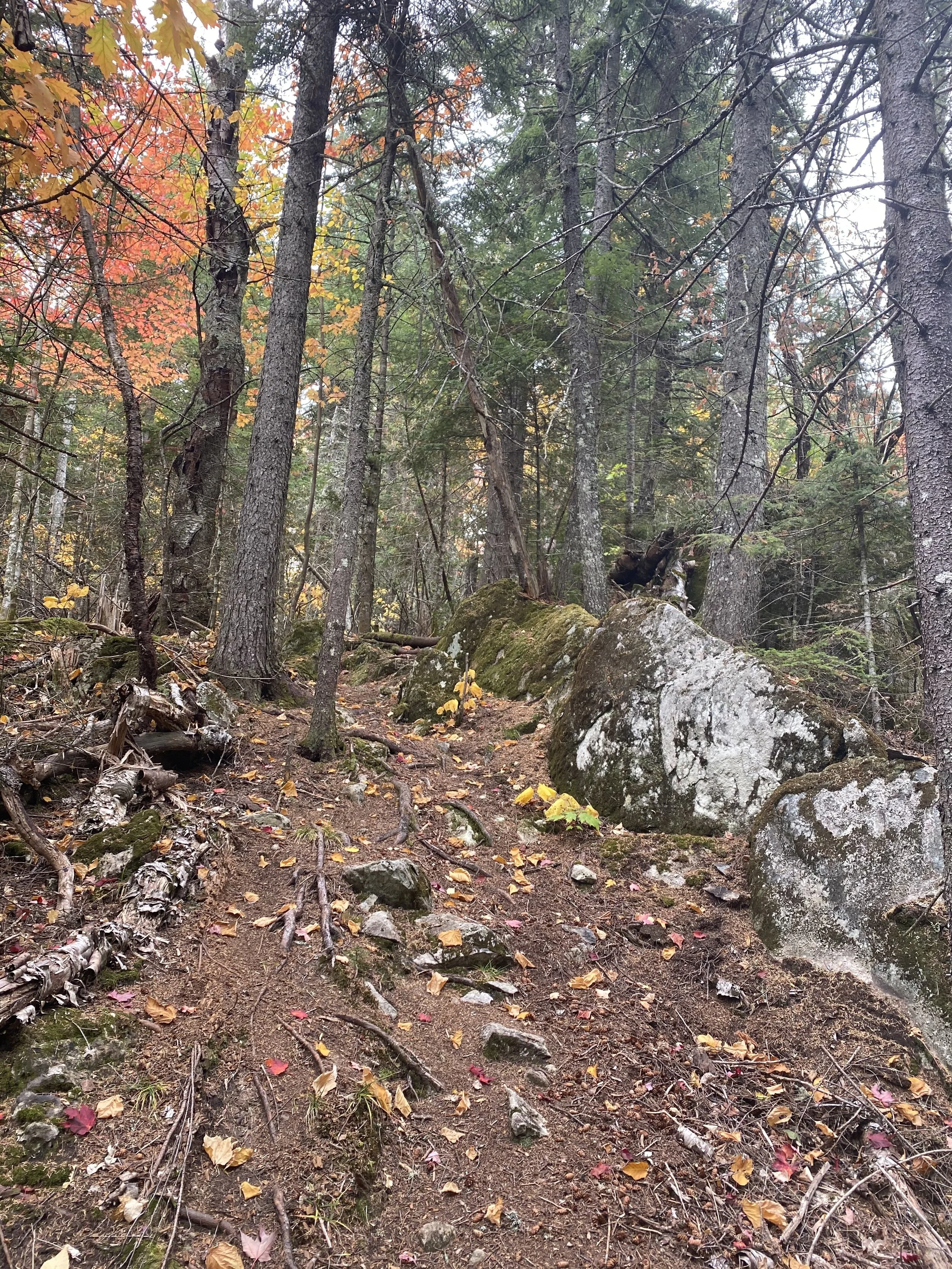
2.3 Descend steadily through bouldery forest beside a brook that tumbles over and between the boulders. Where the brook reaches the valley floor and relaxes into a wider, gentler flow, the trail bears right away from the brook.

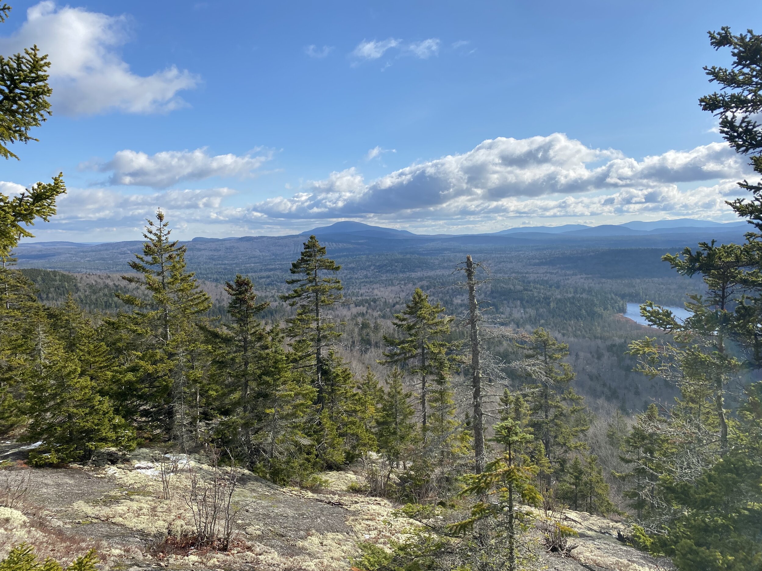
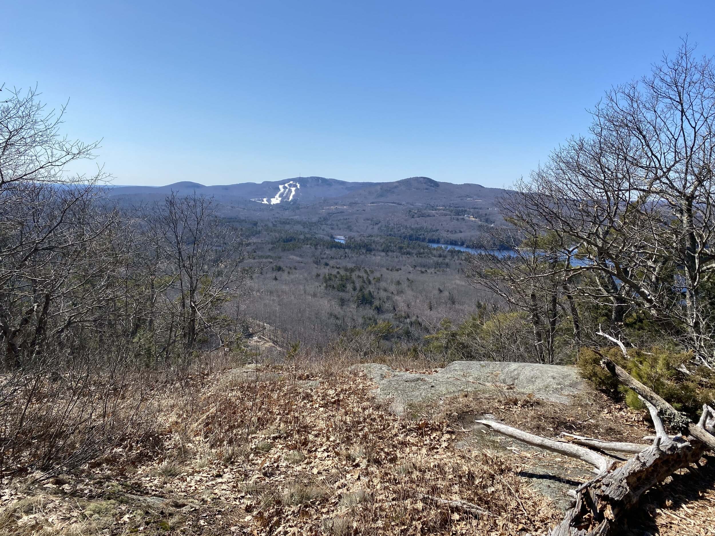
3.2 Cross the valley floor. When the leaves are off the trees you have pretty good views of Third Mountain and especially Fourth Mountain. The trail follows an old woods road. Just when you think the trail is going to descend to the east end of Indian Pond—visible through the trees—the hike turns left (east) onto a yellow blazed trail, leaving the roadbed. (The roadbed actually never reaches the pond. It bears right and follows along the shore on a side hill high above the water.)

3.7 The trail wanders through the woods within sight of Indian Pond and reaches a campsite on the shore of the pond. The trail ends here.

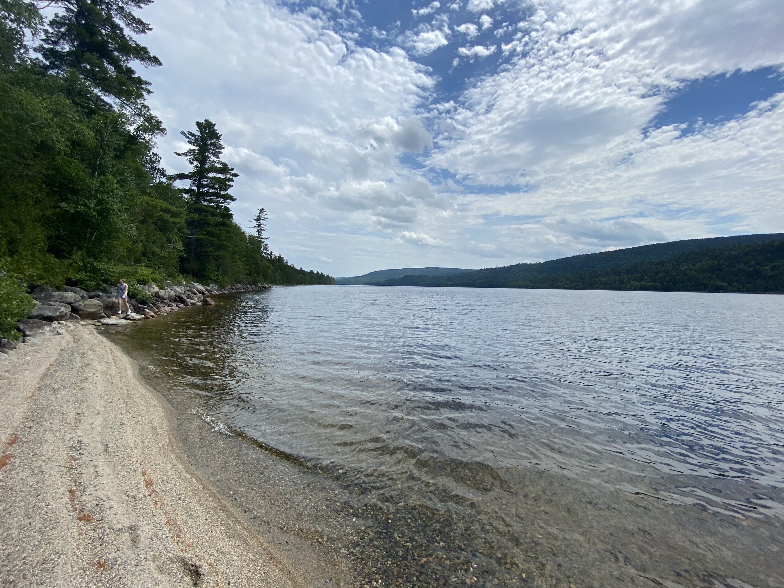
Looking west across Indian Pond to Barren Mountain

To complete the hike, retrace your steps back to the trailhead. This hike offers different things in different seasons. When the leaves are off the trees, you get pretty good views in several places of the surrounding mountains and from the ridge (at the slide). In spring, the hardwood forest on the lower shoulder of the ridge and the valley floor are colorful with wildflowers. In winter, this hike offers an opportunity to break trail on a relatively easy mountainside. In spring and summer, the pond and the woods around it are a good place to find moose. This isn’t the most spectacular hike in the 100 Mile Wilderness, but it offers nice variety and great solitude.

Looking down the ladder

Potaywadjo Ridge by Greg Westrich

Looking east from Potaywadjo Ridge

Looking east from Potaywadjo Ridge

If you’re familiar with the Appalachian Trail in Maine, you’ve probably heard of Potaywadjo Spring. The spring is one of the biggest in Maine. Water bubbles up out of a gravel bowl ten feet across. Nearby is the swankiest lean-to in the state. It’s maintained by LL Bean, and they spare no expense. The privy is a two-holer with seperate doors and curtains on the windows. Next to the lean-to is neatly stacked split firewood. Needless to say, thru-hikers talk about it a lot. What most hikers don’t know is the trail to the top of nearby Potaywadjo Ridge. The trail is well-blazed but is faint in places because so few people use it.

Day hikers generally don’t hike in this area either. It’s a long hike from anywhere. If you hike in from where the Jo Mary Road crosses the AT, you’d be looking at more than 13 miles in and out. I decided to find a shorter way.

Cooper Brook from the bridge

Cooper Brook from the bridge

I dug out all my maps and guides and realized that the AT crosses a snowmobile trail where it follows Cooper Brook. If I could get near Cooper Brook, I could cross and pick up the AT. Turns out that the snowmobile trail is drivable right up to the bridge, which is intact. That means I cut the thirteen mile hike down to 8.0 out and back with 1086 feet of climbing (more than 600 feet of the climbing are on the Potaywadjo Ridge Trail over little more than half a mile). That’s managable, and I didn’t have to ford the stream.

Potaywadjo Ridge map.jpg

To get to the trailhead. Turn west on Jo Mary Road off ME 11 between Brownville and Millinocket. Drive 0.1 miles to the gate. Stop and pay your entrance fee (right now it’s $11 for an adult Mainer—less for kids and seniors, more for out of staters). Drive 6.0 miles to a major intersection. Turn right, staying on Jo Mary Road. Drive 2.8 miles. Turn right onto a smaller road at the sign for Buckhorn Camps. Drive 1.7 on the windy road through cut-over areas past several small side roads. Cross Duck Brook then almost immediately bear left at an intersection, staying on the main road. Drive another 2.4 miles on the same windy road. As you near Middle Jo-Mary Lake, a snowmobile trail goes off the right and the road bears left. Almost immediately you pass the road down to the boat launch (visible a hundred feet away). The road passes through the Buckhorn Camps parking area then bears right. Almost immediately it turns left. Drive 2.1 miles to the bridge over Cooper Brook. This last two miles is kinda rough. I did it with my CRV with no problems. The first section crosses an esker. The sandy road is covered with softball-sized rocks. This is the worst section of the road. Next you pass a turn around on the right and the road enters deeper woods. This section is pretty smooth but the weeds growing on the hump in the middle of the road scrape the undercarriage of your car the whole time. There are a few rocks you need to watch out for along this section. After that, the road passes through a borrow pit. Cooper Brook becomes visible on the right down a steep slope. The road re-enters the woods and is much like before. Just when it’s getting rocky enough to be sketchy, you go around a gentle bend and the bridge appears. Just before the bridge there’s a wide spot where you can carefully turn around. This last two miles seems to be less road than snowmobile trail. To start the hike, cross the bridge on foot and turn right onto the Appalachian Trail.

A rare sight on the AT in Maine: a bridge over a brook

A rare sight on the AT in Maine: a bridge over a brook

The hike:

0.0 Walk across the bridge over Cooper Brook. Turn right on the AT less than 10 feet beyond the bridge.

0.5 The trail wanders through damp woods between Cooper Brook and Mud Brook. You have to cross two channels of Mud Brook. When the water is low, this may be possible without getting your feet wet. The rest of the time, don’t cross the first channel where the trail does (there’s a rope safety line to mark the trail). Bushwack about 100 feet upstream. You’ll find a spot where you can cross on a combination of rocks and logs. You can see Mud Pond as you cross. Across the first channel, angle to the right and bushwack back to the AT. When you get to the second channel, bushwack about 50 feet downstream. There’s a log jam you can cross easily. Across the second channel, turn left and bushwack back to the AT.

Looking up toward Mud Pond from the crossing over the first channel

Looking up toward Mud Pond from the crossing over the first channel

The official crossing of the first channel. Notice the safety line

The official crossing of the first channel. Notice the safety line

1.9 The trail crosses a dry, pine-covered ridge with nice views of Mud Pond. The trail turns away from Mud Pond and heads through classic Maine AT to Lower Jo-Mary Lake. This section is all rocks and roots held together by mud. But the woods are cool and beautiful. You come to a fork in the trail. The AT bears left away from the lake. A blue blazed trail bears right along the shore. Follow the blue blazed trail into Antlers Campground. You come to a wide open area in a stand of tall red pines. To your right is a small beach on the lake. Straight ahead is a trail that leads to several tent campsites. Turn left and walk away from the lake. In a short distance, you reach the AT. Turn right.

Lower Jo-Mary Lake at Antlers campground

Lower Jo-Mary Lake at Antlers campground

Antlers campground

Antlers campground

3.1 The trail leaves the shore of the lake and passes through mixed forest, much more open and sunny than the hike so far. Eventually, the trail returns to the shore of Lower Jo-Mary Lake and crosses a gravel beach.

The beach

The beach

3.4 The trail follows the curve of the shore, crossing a brook on rocks. You climb a bit away from the lake and reach Potaywadjo Ridge Trail. A small sign facing the other way marks the trail. The trail itself is barely visible. It’s pretty overgrown here. Turn left onto Potaywadjo Ridge Trail.

4.0 Potaywadjo Ridge Trail is little hiked, so the trailbed is pretty faint in most places. It is blue blazed. The route is obvious. I was only in doubt twice. Low in the climb a large, fallen tree obscures the trail for about 50 feet and higher up there’s a section of climbing through boulders that is obvious but unblazed.

The climb begings gently through mostly hardwoods. As it steepens the forest becomes more mixed. You climb up through a couple of boulder fields before reaching the first of the ledges. Parts of this climb are very steep, often with loose dirt covered with acorns. Luckily the trail doesn’t go straight up the ridge, mostly you climb as you slab to the west.

Where the trail climbs onto the ledges

Where the trail climbs onto the ledges

4.1 The trail crosses three ledges separated by stands of twisted pines. Each successive ledge is more open with wider views. Near the west end of the third ledge, instead of a blaze, the word END is painted on the rock.

Looking southwest toward Jo Mary Mountain with the White Cap range in the distance.

Looking southwest toward Jo Mary Mountain with the White Cap range in the distance.

From the ledges

From the ledges

While on top, I bushwacked around to see if I could find a view north and of Katahdin. I assumed not for two reasons but felt obligated to check. First, if there was a view of Katahdin, the trail would continue to it. Second, most ridges and mountains in Maine have steep south faces and more gentle north faces. This is a function of the physics of how ice sheet pass over a mountains. That tends to mean you get great open views south and rarely get open views north. That proved to be the case on Potaywadjo Ridge. I did find evidence that moose hang around on the ridge in winter—scat and trails.

One of the ledges not on the trail that is slightly higher than where the trail goes.

One of the ledges not on the trail that is slightly higher than where the trail goes.

8.0 To complete your hike, retrace your steps back to the bridge over Cooper Brook. At Antlers, you can stay on the AT and slightly shorten the return hike (that’s why the distance numbers don’t seem to add up).

Along the AT

Along the AT

Two final notes: Potaywadjo Spring (and lean-to) are 2.0 miles north on the AT from Potaywadjo Ridge Trail. If you’re feeling ambitious or want to make this a two-day hike, the spring is worth seeing. Also, less than a half mile north of PRT a side trail leads down to Lower Jo-Mary Lake and good swimming spot with some beach and rocks.

IMG_3438.JPG

Owl's Head at Scraggly Lake by Greg Westrich

The Traveler across Scraggly Lake from Owl’s Head

The Traveler across Scraggly Lake from Owl’s Head

Scraggly Lake is one of several lakes north of Grand Lake Road east of Baxter State Park. It’s a quiet, remote place. A lake surrounded by rolling, forested hills and dotted with rocky islands. Owl’s Head is one of those hills. It rises east of the lake near its north arm. Near the top of the hill are two rocky outcroppings that offer fine views of the lake and the mountains in Baxter. The hike is 3.4 miles lollipop (a long stick and a small sucker) with only 505 feet of climbing.

To get there, follow ME159 west out of Patten towards Baxter State Park and Katahdin Woods and Waters National Monument. Drive 15.9 miles, passing Shin Pond to Seboeis River. Cross the river and drive another 0.7 miles. Turn right onto Scraggly Lake Road (there’s a sign). Drive 10.4 miles, passing the bridge over Sawtelle Stream (where the trailhead for Sawtelle Falls is), Sawtelle Deadwater, and several side roads. You pass the sign for Scraggly Lake Reserved Land 2.6 miles before the trailhead. The trailhead is on the right just before the bridge over Scraggly Brook. There’s a large informational sign at the trailhead.

Owls Head map.jpg

The hike:

0.0 The trail leads into the woods behind the parking area and just to the right of the sign.

0.6 The trail roughly follows the shore of the arm of Scraggly Lake that becomes the outlet stream. The trail mostly wanders through dense cedars but also crosses a small hill. The trail comes to a bench on the shore of the lake just opposite the boat launch.

Nearing the first bench

Nearing the first bench

0.9 After the first bench, the trail follows the shore around a shallow cove to a second bench.

The second bench

The second bench

1.2 The trail stays close to the shore, but begins to climb a side hill. An marked trail leads down to the lake. This little trail is hike access for people who boated across the lake to Owl’s Head. There is a trail sign facing the lake.

Beginning to climb away from the shore

Beginning to climb away from the shore

1.3 The trail begins to climb a rocky slope. Turn right at the intersection and climb steep steps.

The first steps

The first steps

1.4 The trail climbs the rocky slope to the first overlook. It is unmarked, but it’s obvious where to turn left away from the trail and walk out onto the open ledges. You have an expansive view of Scraggly Lake and the surrounding country. The mountains of Baxter rise behind the hill across the lake. The Traveler dominates the view, but Katahdin peeks out from behind it. You can also see Mt Chase, Sugarloaf, and Deasy Mountain (in the distance).

Looking west from the overlook

Looking west from the overlook

1.6 The trail turns east, away from the lake after the overlook and climbs to the summit. The trail actually passes north of the wooded summit and leads instead to a rocky outcropping. If you leave the trail and hike west 50 feet across the outcropping, you get another great view of the lake and surrounding mountains. This view is more obstructed than the lower overlook, but offers better views north.

Looking northwest from the upper overlook.

Looking northwest from the upper overlook.

Looking across the rocky outcropping to the upper overlook.

Looking across the rocky outcropping to the upper overlook.

1.7 At the rocky outcropping near the upper overlook, the trail turns east (right) and begins to descend. The trail drops quickly down the steep slope to the lake shore.

The beginning of the descent

The beginning of the descent

2.1 The trail loops around Owl’s Head above the lake and beneath the steep, rocky slope topped by the two overlooks. When you reach the intersection, go straight and retrace your steps back to the trailhead.

3.4 Arrive back at the trailhead.

Scraggly Brook from the bridge near the trailhead.

Scraggly Brook from the bridge near the trailhead.

East Grand Highlands Trail by Greg Westrich

The Overlook on an overcast day. The hills across the lake are in New Brunswick.

The Overlook on an overcast day. The hills across the lake are in New Brunswick.

The East Grand Highlands trail network is a 6.0 miles squished lollipop with two sticks. The hike involves 852 feet of climbing. It’s a wonderfully diverse moderate hike with plenty of solitude. The preserve is part of Woodie Wheaton Land Trust’s extensive holding along East Grand Lakes.

The trailhead is about 3 miles south of Danforth on east side of US1. There is a state trailhead ahead sign along the road. The trailhead is between Two Mile Curve and Greenland Cove Road.

East Grand Highlands map.jpg

The hike:

0.0 Follow Overlook Trail from the marked trailhead. This trail is an old woods road.

0.5 Climb gently and pass Sucker Lake Trail.

0.6 A marked side trail on the left leads 75 feet to a large eratic boulder.

The eratic

The eratic

1.6 Arrive at a T-intersection. Turn left, staying on Overlook Trail.

1.7 Arrive at the overlook. There is a deck with a great view of East Grand Lake and the wooded hills of New Brunswick beyond. In the foreground you can see Sucker Lake. There’s a sign on the deck that explains the view. Just behind the deck is a picnic table. To continue the hike, retrace your steps to the T-intersection.

The view from the overlook

The view from the overlook

1.8 Arrive back at the T-intersection. Go straight onto the Boulder Ridge Trail.

2.8 Boulder Ridge Trail descends steeply for a tenth of a mile then rollercoasters along the sidehill. It’s a fun, rocky hike with lots of chances to find mushrooms and wildflowers in season. You reach Sucker Lake Trail. Turn left.

3.1 Sucker Lake Trail descends off the ridge through a boulder field. Many of the rocks are as large as the eratic you visited earlier. Look for orchids and other wildflowers among the boulders and blueberries along the trail.

In the boulder field

In the boulder field

3.8 The trail levels out and crosses a very mossy bog on cedar logs. You then follow an old road bed through the woods to Sucker Lake. As you approach the lake, the trail seems to end at a wide carry trail the descends to the shore of Sucker Lake. After checking out the lake, follow the continuation of the trail along the shore.

A section of the bog boards through the bog

A section of the bog boards through the bog

The view from the southeast end of the lake where the carry trail ends

The view from the southeast end of the lake where the carry trail ends

3.9 Reach the picnic site along the shore of Sucker Lake where the trail ends.

View of the lake from the picnic area

View of the lake from the picnic area

The view of Sucker Lake made me wish I had my kayak with me. The southwest side of the lake is dotted with small, rocky islands and swampy inlets. The northeast end of the lake is out of sight around the curve of the shoreline. It’s a beautiful, wild lake.

To complete your hike, follow Sucker Lake Trail its entire length (1.6 miles), passing Boulder Ridge Trail along the way.

Along Sucker Lake Trail

Along Sucker Lake Trail

5.5 Arrive back at Overlook Trail. Turn left.

6.0 Arrive back at the trailhead.

Another view of the trail through the boulder field

Another view of the trail through the boulder field

Bald Bluff Mountain by Greg Westrich

Bald Bluff Mountain from the road a half mile from the trailhead

Bald Bluff Mountain from the road a half mile from the trailhead

When I included Bald Bluff Mountain as an Honorable Mention in Hiking Maine, the hike was an out and back. Since then, the state built a trail to connect the two ledges that slabs around the shoulder of the mountain through a beautiful forest of towering pines. Now the hike is a 2.0 miles lollipop with less than 400 feet of climbing. The trail visits granite ledges with fine views of the surrounding wildlands and MDI in the distance. You pass through a surprising variety of forest types for such a low mountain. The summit ridge feels like a much higher mountain as you hike among spruce over moss and granite.

To get to the trailhead, drive east on ME9 (the Airline) from the Bangor area. The hike is in the Amherst Community Forest. There are two roads into this large block of state reserved land. You want the one farther east—Ducktail Pond Road. The turn is 9.0 miles past ME 180, 5.6 miles east of Chick Hill Road, 4.1 miles east of the Amherst town line, and 1.2 miles past the first road (Trout Pond Road which leads to Halfmile Bluff). Watch the milage. The signs for Amherst Community Forest sneak up on you—they are far enough off the road that you don’t see them until you are right at them.

Turn onto Ducktail Pond Road. Drive 3.0 miles, passing the trailheads for Partridge Pond and Ducktail Pond. Turn left at the fork, staying on the main road. Drive another 0.8 miles and again turn left, staying on the main road. Drive 0.8 miles through a boulder field. The road descends to a bog. You can see Bald Bluff Mountain across the snag-filled marsh. Drive another 0.5 miles. Parking is on the right just past the sign at the trailhead.

0.0 The trailhead is at the sign just downhill from the parking area. There’s also a small cairn beside the road at the trail.

0.3 The trail climbs gently through young hardwoods, mostly birch and beech. Turn right at the overlook sign.

Because this hike passes through so many forest types, there are a great variety of wildflowers and mushrooms to see in season

Because this hike passes through so many forest types, there are a great variety of wildflowers and mushrooms to see in season

0.4 Climb gently across increasingly ledgy ground to the first ledges. You have nice partial views west and south. The trail continues across the ledges. Look for the faded blue blazes on the ground.

The view across the bog from the first ledges

The view across the bog from the first ledges

1.0 The trail crosses the ledges, then descends into a piney forest. The trail slabs along the ridge before climbing to the ledges below the summit.

IMG_3138.JPG

After a short, rocky climb, the trail pops out onto the ledges. You have fine unobstructed views southeast, south, and west.

Looking southeast from the ledges

Looking southeast from the ledges

Looking south from the ledges. The mountains of MDI are visible between the nearby hills

Looking south from the ledges. The mountains of MDI are visible between the nearby hills

Looking southwest from the ledges. The conical mountain with the tower is Peaked Mountain (Big Chick Hill)

Looking southwest from the ledges. The conical mountain with the tower is Peaked Mountain (Big Chick Hill)

1.1 Cross the ledges, climbing gently. The trail then turns away from the open rock and climbs to the summit. The summit is a large, flat, mostly open expanse of granite. There’s lots of blueberries, huckleberries, lichen, and small spruce trees. But no views.

The summit

The summit

2.0 The trail crosses the open granite summit, then descends gently through a mossy spruce forest. Then descends gently into a mixed forest. You reach the trail you took to the first ledges, closing the loop. Continue straight ahead 0.3 miles to the trailhead.

Indian Pipe

Indian Pipe

This is a good hike to combine with visits to Partridge and Ducktail Ponds. Or you can explore Halfmile Pond and climb the bluff there. Or climb Parks Pond Bluff. Or Eagle Bluff. Or Big and Little Chick Hills. There are lots of good, short hikes close by.

Debsconeag Backcountry West Loop by Greg Westrich

IMG_2944.JPG

Hike 54 in Hiking Maine is the Debsconeag Backcountry. It’s a great hike that visits several of the Debsconeag Lakes (there are eight) and crosses several ledgy hills with nice views. It’s one of the best hikes in Maine to see wildlife—both because of the topography and the relative isolation. But this isn’t the only hike in the area. In fact, the trail system is a figure eight with trailheads in the southeast and the west. The western loop is even more remote and less visited than the eastern loop.

Debsconeag Backcountry North Loop map.jpg

The western loop starts near the end of the Wadleigh Pond Road, more than 25 miles from the Jo Mary gate house. To get to the trailhead, drive north on ME11 out of Brownville. Drive Drive 15.7 miles from the bridge over the Pleasant River. Turn left onto Jo Mary Road (at the sign for Jo Mary Campground). Drive 0.1 mile. Stop and pay the entrance fee. Continue on Jo Mary Road. Drive another 6.0 miles. Turn right, staying on Jo Mary Road. Drive 16.2 miles. Pass the parking for the Turtle Ridge and Tumbledown Dick Trailheads. Continue another 3.9 miles. Turn right at the intersection onto Wadleigh Pond Road. Drive 5.2 miles, passing the Nahmakanta Lake Road, two campsites, and the unmarked road to Pollywog Falls. You will come to a small parking area on the left, then cross the Appalachian Trail. Continue driving for another 2.0 miles. You will pass another parking area on the right, then the AT joins the road. Cross Pollywog Stream. Across the bridge, turn right (the AT goes straight). Drive 1.0 mile toward Nahmakanta Lake Camps (all along the drive, you’ll have seen small signs with NLC on them directing you this way). The parking area for the hike is on the right. There is an information sign with maps. Across the road is the signed trailhead.

The hike is a 9.0 miles lollipop with 1531 feet of climbing. (If you add up the milage on the state’s map, you get 7.5 for the loop. The section from Sixth Pond to and along the lake is longer than listed on their map as is the section from Gould Brook to Seventh Pond.) There are no big climbs, just lots of little ups and downs. The trail is well-blazed and maintained. A lot of the treadway is rocks and ledges, but a fair amount it dirt. It is an excellent hike for spring wildflowers, including trilliums, lady slippers, hobblebush, blue bead lilies, and others.

0.0 200 feet from the trailhead, the trail fords Rainbow Stream. In the summer, the water is only a few inched deep with a washstone bed. In spring the stream is a waist-deep torrent. Plan your hike accordingly. Whatever the season, you can’t cross without getting your feet wet. I bring watershoes and a towel and leave then near the crossing to be picked up on my return.

Emma fording Rainbow Stream

Emma fording Rainbow Stream

0.1 The trail crosses several dry channels of Rainbow Stream, then climbs out of the valley.

0.5 The trail climbs through a rock garden and up onto a ledge with a vew west of Nahmakanta Lake and Nesuntabunt Mountain. This section is typical of the first half of the hike, which is charaterized by huge boulders in the woods, ledges, low cliffs, and rock gardens.

Nesuntabunt Mountain from the first ledge

Nesuntabunt Mountain from the first ledge

Emma hiking past one of the boulders

Emma hiking past one of the boulders

0.9 Descend gently through the rocky woods to an old, mossy bridge over Gould Brook.Cross the bridge and turn left.

2.3 Climb gently then roller-coaster along a wooded ridge. You pass two blazed but un-signed trails on the left that go to Gould Pond. You pass several ledges and cliffs. The last one is the highest and has an overhanging section.

IMG_2938.JPG

2.4 Descend steadily to a beaver flowage at the head of the Debsconeag Lakes chain.

2.6 Reach Eighth Debsconeag Pond.

Eighth Debsconeag Pond

Eighth Debsconeag Pond

3.0 Pass a second beaver flowage downstream from Eighth Debsconeag Pond.

3.2 Cross the outlet stream and climb up toward the ledges.

3.3 Reach the first ledges.

IMG_2945.JPG

3.6 Rollercoaster along the ledges, tending up to the high point on the hike at an intersection. You have some partial views along this section. Turn right and descend steadily.

4.0 Descend steadily on ledges with some fine views to Seventh Debsconeag Pond.

Seventh Debsconeag Pond

Seventh Debsconeag Pond

4.1 Cross the outlet stream.

4.9 Cross through hardwood forest to Sixth Debsconeag Pond. A side trail leads 200 feet to the ledgy shore of the pond.

Emma on the shore of Sixth Debsconeag Pond

Emma on the shore of Sixth Debsconeag Pond

5.0 Turn right at an unsigned intersection.

5.6 Descend through the woods to a rocky gorge with a spring in it. The spring creates a mossy brook that flows down to the floor of the ravine and then disappears (the water emerges in a marshy area another tenth of a mile on).

The rocky gorge

The rocky gorge

5.8 Descend to the shore of Nahmakanta Lake.

6.5 The trail turns right and follows the shore of the lake, passing a small, hidden beach.

Emma on the beach

Emma on the beach

Emma cooling off in the lake with Nesuntabunt Mountain in the background

Emma cooling off in the lake with Nesuntabunt Mountain in the background

7.5 The trail continues along the lake to its north end. At the marshy area where Rainbow Stream flows into the lake, the trail bears right and leaves the lake.

8.1 Climb gently away from the lake to the bridge over Gould Brook. Turn left and cross the brook, then retrace your steps back to the trailhead.

9.0 Arrive back at the trailhead.

Notice the checker fly in the middle of the frame

Notice the checker fly in the middle of the frame

This hike passes a lot of water, but in the end it’s a hike about granite. There are miles of ledges and numerous cliffs and boulder fields. That means some nice views and lots of blueberries.

Moxie Mountain by Greg Westrich

For the last twenty years, Chris Keene has been telling me that I needed to climb Moxie Mountain. No, not Moxie Bald that the AT crosses. Moxie Mountain. It’s across Pleasant Pond from Pleasant Mountain in Caratunk. So, yesterday for Father’s Day, I did a family hike up Moxie Mountain using South Trail. What a great hike. Don’t know what took me so long to get around to this one.

Emma crossing a ledge with the overlook ledge in the distance

Emma crossing a ledge with the overlook ledge in the distance

The hike is a 3.4 miles out and back with 1455 feet of climbing. The middle section is steep with lots of loose footing. I would rate the hike strenuous.

Emma on a steep section

Emma on a steep section


To get to the trailhead from ME16, turn north onto Townline Road at the Moscow/Mayfield townline. (If you’re coming from the west, you can pick up Deadwater Road in Bingham and start from there.) Drive north on Townline Road through some recent cutting. Drop down to Deadwater Road 2.8 miles from ME16. Bear right. (A left turn would take you into Bingham.) Drive 2.2 miles (5.0 miles from ME 16). Turn left onto Heald Pond Road. There is a sign at the junction. Drive 2.7 miles (7.7 from ME16). Bear left. Drive 0.7 miles along the south shore of Heald Pond. This section of road has a couple of rough patches, but with care can be driven with an SUV. Turn right where Heald Pond Road bears left and climbs. (8.4 miles from ME16.) Drive 1.1 miles with occational views of Moxie Mountain. Park on the right just before the trailhead sign. (9.5 miles from ME16.)

Moxie Mtn map (2).jpg

The hike.

0.0 There is a new sign beside the road at the trailhead. The trail begins as a wide, grassy lane that climbs gently.

0.5 On the right an unmarked trail climbs a few feet to a spot with a fine view of where you’re going.

Moxie Mountain from along the trail

Moxie Mountain from along the trail

0.7 The trail turns right and leaves the grassy lane. This is where the climbing begins in earnest.

Henry climbing past a cliff in the woods

Henry climbing past a cliff in the woods

The bedrock on the mountain is rough but lacks the bi-colored crystals of a granite. This is the southern end of a pluton of gabbro. It’s a volcanic rock that is related to basalt. You’ll notice that the trail is often comprised of tiny, crystals that make for slippery footing. The bedrock itself is quite rough and easy to scramble up. There are a couple of places on the climb where it feels like you entered the beach or a desert.

The gabbro bedrock weathers into rough sand

The gabbro bedrock weathers into rough sand

1.3 The trail climbs across a ledge with fine views then rollercoasters to a junction. A marked side trail leads 200 feet to an open ledge with spectacular views south and west. You can count off 8 of Maine’s 4000 footers: Abraham, Sugarloaf, Spaulding, North Crocker, South Crocker, Redington, Avery Peak, and West Peak. Saddleback and The Horn are behind Abraham.

The view from the ledges

The view from the ledges

1.4 Just past the overlook side trail, you come to a signed junction. The trail to the left crosses open ledges then descends to the Deer Bog Trailhead. To the right it’s 0.3 miles to the summit (the sign says 0.4).

1.6 This section is less steep that below the overlook but there’s more exposed bedrock to climb. You reach open ledges just short of the summit with great views.

From the summit ledges. Notice the overlook ledges in the middle ground

From the summit ledges. Notice the overlook ledges in the middle ground

1.7 The trail ends at the mostly wooded summit where there are two short towers, a building, and a solar array. A short side trail leads north to the helipad. From atop the helipad you have a good view north.

The view from the helipad. Pleasant Pond is on the left beneath Pleasant Mountain. Moxie Bald (both summits are clearly visible) is the rocky mountain on the right. You can see all the mountains around Moosehead Lake behind Moxie Bald.

The view from the helipad. Pleasant Pond is on the left beneath Pleasant Mountain. Moxie Bald (both summits are clearly visible) is the rocky mountain on the right. You can see all the mountains around Moosehead Lake behind Moxie Bald.

3.4 To complete your hike, retrace your steps back to the trailhead. This is a good hike for forest wildflowers. On our hike we saw a dozen in bloom, incuding bunchberry, lady slippers, blue bead lilies, and blackberries. High on the mountain are a lot of blueberries that will be ripe by August. Low on the mountain and on the drive in there were tons of butterflies. The most common were Atlantis Fritillarys.

Atlantis Fritillary on blackberry blossoms

Atlantis Fritillary on blackberry blossoms

White Cap Mountain via White Brook Trail by Greg Westrich

White Cap from Chairback. Big Spruce Mountain is partially blocking it.

White Cap from Chairback. Big Spruce Mountain is partially blocking it.

White Cap Mountain, at 3654 feet, is the highest mountain between the Avery Peak and Katahdin on the Appalachian Trail. To its southeast are a collection of rugged, untrailed mountains over 3000 feet (the Boardmans and the Spruces). From the summit you can see all the mountains in the 100 Mile Wilderness and around Moosehead Lake. On a clear day, you can see the Bigelows and have a spectacular view of Katahdin.

Snow-capped Katahdin from just below the summit.

Snow-capped Katahdin from just below the summit.

You can see White Cap from the hill on Broadway in Bangor as the road drops down to Dysarts. The summit has been snow free for some time this spring, so I decided to head up and climb it from the south. Most people climb White Cap from the north, hiking up the Appalachian Trail from the end of Frenchtown Road (see my August 19, 2019 blog post for a description of that route). I first climbed White Cap from the south about 25 years ago. Since then, the road in has deteriorated to the point that you had to walk the last four miles to the trailhead. A couple of years ago, they logged the valley below the mountain again and fixed the road to the White Brook Trailhead.

To get there from Route 11 in Brownville, drive north 4.9 miles past the bridge over the Pleasant River. Turn left onto the KI Road at the sign for Gulf Hagas. Drive 6.5 miles to Katahdin Iron Works. You have to register and pay an entrance fee here. Cross the West Branch Pleasant River (this is the river that flows through Gulf Hagas) and turn right. Drive 3.5 miles. Bear right at the sign for High Bridge. Drive 2.2 miles. Turn left and cross High Bridge. Drive another 3.7 miles. THIS SECTION OF ROAD HAS SEVERAL SPOTS THAT ARE EITHER WASHED OUT OR VERY ROUGH. The worst is about 2 miles beyond HIgh Bridge. I made it in my Honda CRV, but it’s pretty sketchy. The road ends at a large gravel cul de sac with a huge pile of gravel at the far end. Park here.

High Bridge

High Bridge

The hike is a 6.4 miles out and back with 1838 feet of climbing. This is a slightly easier hike than climbing White Cap from the north.

0.0 The first 1.2 miles of the hike are on what’s left of the road beyond the parking area. The route is easy to follow, but sometimes looks like an old road bed and sometimes looks like an overgrown trail and sometimes looks like a moose trail. There are occasional cairns (that have mostly fallen over) and a blaze or two on rocks on the ground. Along this section, you get views of Hay and White Cap Mountains as you approach the saddle between them.

One of the more open sections of the approach trail. This is good moose habitat.

One of the more open sections of the approach trail. This is good moose habitat.

1.2 Eventually, the trail reaches an open area that is somewhat overgrown. Stay to the left and look for the cairn with a faded blaze on it. This is the White Brook Trailhead.

White Brook Trailhead

White Brook Trailhead

1.6 The trail climbs gently to a pretty crossing of White Brook.

White Brook at the crossing

White Brook at the crossing

1.7 The trail climbs away from the brook to a junction with two signs. The trail used to fork here, but doesn’t any longer. In 2020 the MATC volunteer who maintains area cut a new trail from here to the AT. Turn left at the junction (the only way to go).

IMG_2771.JPG

2.1 The trail switchbacks up the steep slope, then climbs steadily to the Appalachian Trail. Turn right and head north on the AT.

Climbing toward the AT

Climbing toward the AT

3.2 The AT climbs steadily to the summit ridge then is relatively flat to the summit. (When I did this section on May 15,2021, there was still two feet of snow on the ground under the trees even though the summit itself was dry.)

Where the trail breaks out of the trees the first time. You have great views north and west.

Where the trail breaks out of the trees the first time. You have great views north and west.

The summit sits at the edge of a stand of stunted spruce that block the view north. But the slope of loose rock below you (that give the mountain its name) allow for spectacular views east, south, and west.

The summit

The summit

Looking west from the summit

Looking west from the summit

To get the best view of Katahdin and BIg and Little Spencer Mountains, continue north on the AT around the summit for about 0.1 miles.

Snow-capped Katahdin in the distance from along the AT just north of the summit

Snow-capped Katahdin in the distance from along the AT just north of the summit

The Spencers from just north of the summit along the AT

The Spencers from just north of the summit along the AT

After your hike, be sure to stop and visit White Brook at HIgh Bridge. The stream falls into a sculpted gorge before passing under the bridge. It’s a cool formation and a good swimming hole.

The small gorge on White Brook at High Bridge

The small gorge on White Brook at High Bridge

Exploring Tunk Mountain by Greg Westrich

20170704_114447 (2).jpg

Tunk Mountain seen from Spring River Lake

Tunk Mountain rises north of ME182 in the Donnell Pond reserved lands in an unorganized township between Franklin and Cherryfield. (For full directions and description of the main trail see Hiking Maine.) It’s a popular hike because of the expansive views from the rocky summit ridge. The hike is just challenging enough to make you feel like you really earned those views of the mountains of Acadia and the Downeast coast.

Looking toward the coast from near the summit

Looking toward the coast from near the summit

If you’re like me, you’ve climbed Tunk Mountain and wondered what else there was to explore. Are there waterfalls on the mountain? How do you get to Tilden Pond (that you can see from the mountain)? Where exactly is the actual summit? Am I missing anything by just following the trails?

So, I decided to remap Tunk Mountain and find the answers to my questions.

The complete map of official and unofficial trails on and around Tunk Mountain

The complete map of official and unofficial trails on and around Tunk Mountain

I’m always on the lookout for waterfalls. Both because I wrote a guide to Maine waterfalls and am always thinking of how to make it better. And, well, I like waterfalls.

The trail system on Tunk Mountain passes two seasonal waterfalls. The best time to see them is beginning when it warms up enough to start melting the ice and snow. By the time the snow is gone, both waterfalls are little more than trickles. The easiest waterfall to find is on a small brook the trail follows above Mud Pond. Almost exactly 1.0 mile from the trailhead, the trail makes a right turn away from the brook. If you continue straight along the stream, there’s a small waterfall (about three feet) right away and a nice drop down a sheer rock face in about 200 feet. Above the rockface is a small boggy area that the water flows out of.

IMG_2504.JPG

The second waterfall is accessible from the Hidden Ponds trail. To get to it, hike from the trailhead 0.7 miles. Turn right onto the Hidden Ponds trail (for some reason this end of the loop is unsigned). Hike 0.8 miles past Salmon Pond and on to the clifftop overlook of Little Long Pond. Just before you got to the overlook, you crossed Salmon Brook on bog boards. The waterfall is where this brook drops to the level of Little Long Pond. To get there, follow the unmarked but obvious trail along the cliff to the right (south) of the overlook. Stay high. It looks like you should downclimb. Don’t. Hike a few hundred feet farther and there’s an easier place to climb down. When you reach the level of the pond. You’ll see and hear the waterfall dropping off the rock face into a braided stream that feeds into the pond.

Salmon Brook Falls when it’s still mostly frozen

Salmon Brook Falls when it’s still mostly frozen

From the waterfall, you can make your way across the stream on the numerous mossy boulders and climb the rough trail to the top of the cliffs on the east side of the cove. The cliffs here are more open and expansive than on the west side where Hidden Ponds Trail is—there the clifftops are wooded. There’s also a trail that drops down to the shore of Little Long Pond where you have a nice view of Tunk Mountain and the long, ledge-studded ridge east of the mountain. (This ridge is untrailed. Over the summer I plan to bushwack out it to check out the views.)

Tunk Mountain hiding in a cloud from the shore of Little Long Pond

Tunk Mountain hiding in a cloud from the shore of Little Long Pond

An enlargement of the map that shows the location of the two waterfalls

An enlargement of the map that shows the location of the two waterfalls

From Momument Vista and the nearby ledges, you get great views of the lakes and ponds south and east of the mountain: Little Long Pond, Salmon Pond, Tilden Pond, and Spring River Lake (you can’t see Mud Pond—it’s tucked in a cleft below you out of sight). The Tunk Mountain trail skirts the west end of Salmon Pond and the Hidden Ponds Trail loops around Salmon Pond and visits Little Long Pond. But none of the official trails go to Tilden Pond.

In fact, there is a no longer maintained trail to Tilden Pond. From the trailhead parking area, hike 0.5 miles to the first (unsigned) intersection with Hidden Ponds Trail. Turn right on that trail and hike 0.1 miles on the sidehill along Salmon Pond. You reach a spot where the trail bears left and descends to the shore of Salmon Pond. At the bend, there’s a small sign on a tree: End of Maintained Trail.

IMG_2485.JPG

Sure enough, a trail leaves Hidden Pond Trail at the sign. Bear right off Hidden Ponds Trail and follow this obvious trail. The Tilden Pond Trail is relatively flat and in good shape. It’s 0.7 miles from Hidden Pond Trail to the shore of Tilden Pond. From the south shore of the pond, you have fine views of Tunk Mountain and its long east ridge.

the view of Tunk Mountain from Tilden Pond on a cloudy day

the view of Tunk Mountain from Tilden Pond on a cloudy day

Tunk Mountain Trail crossed the summit ridge from the south-facing ledges to the north ledges, but never crosses the summit. There is a trail to the summit, though. It’s just not an official trail and therefore not signed or blazed. To find it, climb up the ledges on Tunk Mountain Trail. The trail leaves the ledges and enters the woods as it’s crossing the summit ridge. Almost as soon as you enter the woods, look for a trail on the left (west). Step down off the rock and follow this trail. It heads through the woods and crosses a granite ledge in the woods. Descend off the ledge. There’s flagging in the trees all along this trail. Off the ledge, the trail forks. Bear right and follow the obvious and flagged trail. The trail skirts around the north side of a large mass of bedrock as high as the forest. Around this formation the trail climbs along its west end to a flat. A heads left up this formation. It’s worth checking out, but it’s not the summit and has no views. Instead, turn right and continue to follow the Summit Trail. Again, you skirt around the north side of a large rock formation. This is the summit. The trail comes out on a large open granite area. To your right is a small building bolted to the bedrock. To your left, the granite rises in a gentle curve to the summit. There’s a USGS survey marker imbedded in the rock at the summit. It’s 0.2 miles from Tunk Mountain Trail to the summit.

The summit

The summit

Looking south from the summit on a very cloudy day

Looking south from the summit on a very cloudy day

After enjoying the summit, walk over to the ledge the building is bolted to. You have a good view to the north. If you look west, you’ll see that the ledge drops straight down to the woods. On a tree against the ledge is a piece of flagging. Climb down off the ledge. You’ll see that the trail continues. Follow it a few hundred feet to a large, open ledge that drops way down. You have a great view here. You’re far enough west that Caribou and Catherine Mountains don’t block your view of MDI. You can also see Mud Pond below you.

The trail actually descends all the way off the mountain to Myrick Pond Road. But your car is at the Tunk Mountain Trailhead, so eat a snack on the steep rock and then head back the way you came.

The clouds begin to lift, revealing the coast. Notice Mud Pond and Salmon Pond below the cliffs

The clouds begin to lift, revealing the coast. Notice Mud Pond and Salmon Pond below the cliffs

Looking west from the ledges near the summit. On a clear day, you can see Blue Hill and the Camden Hills

Looking west from the ledges near the summit. On a clear day, you can see Blue Hill and the Camden Hills

Two further bits of exploring to mention. First, especially in the winter, you' may notice Spring River Lake east of the trail at about the 0.3 mile mark (near the low, wet area you cross on bog boards). There’s a marked bushwack to the shore. Where the trail turns left at the first giant boulder, you’ll notice some flagging in a tree south of the boulder. More flagging and large blazes lead east to the lake. There’s no trail and the ground is mostly very uneven, moss-covered boulders. The blazes are actually a property line. To the left is state land; to the right posted private property. You can make it to the shore of the lake without trespassing.

From the shore of Tilden Pond, you’ll notice several open ledges on Tunk Mountain’s long east ridge. I plan to bushwack around Tilden Pond and up this ridge. I would come out at or just above Monument Vista. If it looks like a good route, I plan to suggest to the powers that be that they make it a maintained trail. Stay tuned!

Sometimes it is all fun and games

Sometimes it is all fun and games

Sugarloaf Mountain (T5 R7) by Greg Westrich

Katahdin (in cloud) and the mountains of Baxter from Sugarloaf’s open summit

Katahdin (in cloud) and the mountains of Baxter from Sugarloaf’s open summit

Sugarloaf is a small, conical mountain east of the north end of Baxter State Park. From the open summit you have fantastic views across the wide Seboeis and East Branch River valleys of the mountains in Baxter State Park. Unlike those mountains which are granite (Katahdin and southern Baxter) or rhyolite (The Traveler and northern Baxter), Sugarloaf is built of some of the oldest bedrock in Maine. It’s famous for the abundance of fossils in the rock—although the capstone bedrock of the summit area is igneous rock that doesn’t have fossils. The fossils are found on exposed bedrock lower on the mountain. The fossils are sea creatures dating back more than 400 million years. I was only able to find some partial clam-like shells along the trail.

IMG_1806.JPG

The hike is 2.0 miles out and back with 900 feet of climbing.

To get to the trailhead, exit I-95 at the sign for Baxter State Park and Katahdin Woods and Waters National Monument’s north entrances. Follow ME11 north into Patten. Turn left onto ME 159 (at the signs for the parks). Drive 5.7 miles. Turn left onto Grandin Road. NOTE: Grandin Road looks like a woods lane that doesn’t go anywhere. Check your milage! There is a street sign where you turn. Drive 6.0 miles on Grandin Road (passing through the corner of a unit of KW&WNM). Bear left amidst some recent cutting. Drive 0.7 miles to a four-way intersection. Go straight, staying on the same road. Again, this way looks wrong because it’s the smallest and roughest of the choices. Drive 0.6 miles to a T-intersection. Turn left. Drive 0.2 miles to the trailhead. There’s a small turnout for parking and a sign at the trailhead. This drive in is rough in places, but doable with a car with reasonable ground clearance (such as the CRV I drive).

0.0 Sugarloaf Trailhead.

0.9 Climb gently through hardwoods (a good place to find spring wildflowers), then steadily through evergreens to a rocky overlook.

The climb near the overlook

The climb near the overlook

1.0 Climb beyond the overlook to the open summit. You can explore the summit area beyond the clifftop to get various views in every direction. The valleys around the mountain are extremely colorful in the fall.

2.0 To complete the hike, retrace your steps back to the trailhead.

On your drive out, you can take the American Thread Road (there’s a sign at the intersection) and explore this isolated unit of KW&WNM. This road is pretty rough in places and overgrown. But it passes two short hikes to beautiful ponds where ducks, beaver, and moose can often be found.

Katahdin hiding in clouds from the summit

Katahdin hiding in clouds from the summit

On the summit with a couple of ravens and a cloud

On the summit with a couple of ravens and a cloud

Looking east from the summit to Mount Chase

Looking east from the summit to Mount Chase


Wadleigh Mountain by Greg Westrich

The trailhead on a November day

The trailhead on a November day

The Hike to Wadleigh Mountain is part of the new Great Circle Trail in the Nahmakanta Public Reserved Land. The hike starts from the Third Mushquash Pond Trailhead along the Nahmakanta Road (the road that runs between Jo Mary Road and Second Roach Pond). It’s a 7.3 miles out and back hike through some gorgeous woods to a cliff top overlook.

Fern-covered boulder among the evergreens

Fern-covered boulder among the evergreens

To get to the trailhead, drive north on ME11 out of Brownville. Drive 15.7 miles. Turn left onto Jo Mary Road (at the sign for Jo Mary Campground). Drive 0.1 mile. Stop and pay the entrance fee. Continue on Jo Mary Road. Drive another 6.0 miles. Turn right, staying on Jo Mary Road. Drive 16.2 miles. Pass the parking for the Turtle Ridge and Tumbledown Dick Trailheads. Continue another 3.9 miles. Turn left at the intersection onto Nahmakanta Road (that leads eventually to Second Roach Pond). Drive 1.0 mile uphill. Turn right into the parking area just past a giant boulder sitting beside the road. The trailhead is at the north end of the parking area marked with two signs. (Across the road is the continuation of the Great Circle Trail that connects to the Turtle Ridge loop between Sing Sing Pond and Turtle Ridge.) From the parking area, you have a fine view of Katahdin.

The distance on the signs at the trailhead are not accurate. It’s 2.3 miles to the campsite and 3.7 miles to the summit of Wadleigh Mountain.

0.0 Third Musquash Pond Trailhead (in some places on the Great Circle Trail, this trailhead is called Katahdin View).

1.5 The trail is new, so there really isn’t much of a footbed yet. The trail is very well blazed, so you wander among bounders and mossy rocks through second growth hardwoods from blaze to blaze. Periodically, the trail passes through a ledgy section where granite errupts to the surface and the hardwoods give way to evergreens, especially hemlocks. I dubbed one of these granite erruptions The Whale becaue it looks like a great blue whale breaching the surface. When you hike past it, you’ll recognize it immediately.

The trail reaches Third Musquash Pond’s outlet stream. The trail makes a hard left where the brook crashes through a series of granite ledges cracked into an ill-fitting wall.

Looking up the brook toward where the trail reaches the granite ledges

Looking up the brook toward where the trail reaches the granite ledges

The trail follows along the south side of the brook through moss-covered boulders, then bears right and crosses the brook on a small bridge.

IMG_2051.JPG

The trail continues following the brook past a narrow canyon and other features.

Looking down the small waterfall at the head of the narrow canyon

Looking down the small waterfall at the head of the narrow canyon

2.2 The trail climbs away from the brook where it flows out of a marshy swale. On your right, is a recently cut area. Several skidder trails reach down to the trail. The trail drops back down to the brook, which is now the narrow, marshy east end of Third Musquash Pond. A short, unmarked but blazed trail leads 100 feet to the water. Look for beaver, wood ducks, and moose here.

2.3 The trail passes a second blazed but unmarked side trail. This one leads to the campsite on the shore of the pond. You have a nice view of the pond and Farrar Mountain in the distance.

2.5 The trail passes a third side trail that leads out to the pond. From the marshy shore, you can look to the hard right and see the ridge of Wadleigh Mountain, including the ledges where the overlooks are.

Third Musquash Pond (with the shoulder of Wadleigh Mountain to the right)

Third Musquash Pond (with the shoulder of Wadleigh Mountain to the right)

3.5 The trail begins to climb gently away from Third Musquash Pond. As you near the ridge of Wadleigh Mountain, the trail becomes steeper. You switchback up the rocky slope, following a cleft in the ridge. Near the top, the trail turns left and slabs around the ridge to a blazed side trail out to the ledges. Make sure when walking out onto the ledges that you don’t stop at the first viewpoint. The trail continues through some trees to the most open overlook (look for flagging in the trees).

Looking west across the lower ledges

Looking west across the lower ledges

Jo Mary Mountain and Third Musquash Pond from the ledges

Jo Mary Mountain and Third Musquash Pond from the ledges

From the side trail to the lower overlook, Bear right and climb steeply 200 feet to the side trail to the upper overlook.

3.7 Past the overlooks, the trail wanders from ledge to ledge, climbing in fits and start to reach the wooded summit. Until recently there was a tower on the summit. You can still see the plates and bolts where it was attached to granite.

Wadleigh Mountain’s summit

Wadleigh Mountain’s summit

The trail makes a hard left off the summit and continues all the way to the Appalachian Trail at Crescent Pond, passing Wadleigh Pond, Pollywog Pond, and the Pollywog Falls along the way. But that’s another hike. For this one, just retrace your steps back to the Third Musquash Pond Trailhead.

Clouds refected in Third Musquash Pond as seen from the campsite

Clouds refected in Third Musquash Pond as seen from the campsite


Halfmile Bluff by Greg Westrich

Halfmile Bluff across Halfmile Pond

Halfmile Bluff across Halfmile Pond

Along the Airline (ME 9) east of Bangor, there are numerous small mountains and hills with open ledges that have great views. Most folks know about Big and Little Chick Hills (really Big and Little Peaked Mountains). The rock climbing community has openned access to a couple of others, most notably Eagle Bluff and Parks Pond Bluff. The farthest east of these bluffs is Bald Bluff Mountain. The least well-known is Halfmile Bluff in the Amherst Mountains Community Forest.

The hike visits the beautiful Halfmile Pond then climbs steeply to the viewpoints on the bluff. The hike is only 2.0 miles out and back, but the trail up the climb is not well-defined and very steep. The view is worth the work, though.

Looking across Halfmile Pond from the bluff

Looking across Halfmile Pond from the bluff

To get to the trailhead, drive east on the Airline (Maine route 9) through Eddington into Clifton. From the junction of ME9 and ME180 in Clifton, continue on the Airline. Drive 7.8 miles, passing Parks Pond then Chick Hill. Turn left onto Trout Pond Road at the new sign for Amherst Public Land. If you reach the village of Amherst, you went way too far. (Also, note that there’s a second marked road into Amherst Public Land between Trout Pond Road and the village—this is the road to Bald Bluff Mountain.)

Drive 1.7 miles on Trout Pond Road. It’s a well-maintained but narrow gravel road. Turn right at the sign for Halfmile Pond. Drive another 0.7 miles to where the road peters out. There’s a parking area on the left and a trailhead sign on the left side of the road just past the parking area.

0.0 The trail is on the north side of the road (where it becomes little more than an overgrown skidder trail) at the sign.

0.2 Descend steadily to the south shore of Halfmile Pond. You have a great view of the bluff on the far shore.

IMG_1569.JPG

0.3 A blue blazed trail heads east along the shore of the pond. The pond is shallow and home to several kinds of flowering aquatic plants and the animals that go with them. The trail reaches the end of the pond and seems to end. Turn left and cross an old, abandoned beaver dam to the far shore.

IMG_1559.JPG

0.8 Across the dam, an obvious trail leads into the woods. It is occassionally flagged but not blazed. The trail heads in a straight line toward the bluff through a forest littered with boulders. The trail reaches the base of the bluff. You begin climbing to a fork. An obvious trail climbs steeply to the left. This is a red herring. It climbs to a ledge between the lower and upper cliffs. You can bushwack across the ledge to several fine overlooks and nice views of the upper cliffs.

Looking up the cliffs from the lower ledge

Looking up the cliffs from the lower ledge

1.0 To continue the hike, turn right at the fork. The trail goes through some boulders at the base of a cliff. Then you climb very steeply beside the end of the cliffs to the top of the bluff. The trail crosses the top of the bluff to an overlook. There are a couple of viewpoints along the trail that you can bushwack to.

Looking across Halfmile Pond from the overlook. You can see the mountains on MDI peeking out from behind the hill in the distance.

Looking across Halfmile Pond from the overlook. You can see the mountains on MDI peeking out from behind the hill in the distance.

On your return hike, take time to explore the woods and cliffs before reaching the pond. You never know what you might find. The last time I was there a large mixed flock of chickadees and warblers was feeding in the trees near the end of the pond. The woods are full of wildflowers in the spring, including lady slipper orchids that grow right in the trail.

Elm sawfly larva on the moss in the trail

Elm sawfly larva on the moss in the trail

The pond itself is also a great place to find wildlife. I haven’t seen one, but the area looks like good moose habitat. Lots of yummy aquatic plants to eat.

Looking up the pond from the dam

Looking up the pond from the dam

Horserace Pond Loop by Greg Westrich

Katahdin from one of the ledges

Katahdin from one of the ledges

There are lots of good, underuntilized hikes around the perimeter of Baxter State Park. The Horserace Pond Loop in the Nature Conservancy’s Debsconeag wilderness is one of the most spectacular. The hike visits six lakes and ponds, climbs open ledges with expansive views, passes through gorgeous, moss and boulder forests, and offers fine opportunites to view wildlife. Horserace Pond is one of Maine’s best secret swimming holes. The deep pond is surrounded by granite boulders that offer good access and places to sit after a dip in the cool water. The pond sits in a steep valley between two ridges, one with a large area of cliffs that loom over the pond. There are campsites at the east end of the pond that you can use on a first-come first serve basis. The ledges far above Horserace Pond offer fine views of the surrounding country ncluding a great view of Katahdin.

Horserace Pond

Horserace Pond

The full hike is a 9.3 miles lollipop (If you skip the out and back to Rainbow Lake, it’s a 6.5 miles lollipop). There are 1968 feet of climbing involved. The ridge is less than 1700 feet high, but there’s lots of up and down along the ridge and getting to Rainbow Lake. Because of the distance and the amount of climbing, the hike is rated strenuous. The trails are well-marked and maintained.

Horserace Pond Loop map.jpg

To find the trailhead, follow the road out of Millinocket toward Baxter State Park. 1.3 miles past the pinch between Millinocket and Ambejejus Lakes where Northwoods Trading Post is, turn left on the gravel road that connects to the Golden Road. Drive 9 miles on the Golden Road to Abol Bridge. Cross Abol Bridge and enjoy the view of Katahdin. Continue another 5.2 miles on the Golden Road. Turn left onto the Horserace Pond Access Road at the sign. Drive 0.2 miles to the end of the road where the trailhead is.

The hike:

0.0 Horserace Pond Trailhead. There’s a sign with info and a good map of the Debsconeag wilderness. The trail crosses Horserace Brook on a bridge.

0.6 The trail follows an old roadbed most of the first section. You pass through two old roadcuts before reaching a junction. Turn left onto the blue-blazed trail toward Rainbow Lake.

1.6 Climb steadily through mixed forest with some real giants the the shoulder of a ridge. Pass the orange-blazed trail.

IMG_1371.JPG

2.1 Descend steadily to Clifford Pond. Don’t bushwack over to the shore when you first reach it. There’s a short side trail to the pond farther ahead.

Clifford Pond

Clifford Pond

2.6 The trail wanders through the woods to the shore of Woodman’s Pond. The section of trail along this pond is pretty overgrown but easy to follow.

Woodman’s Pond. The ledges along the orange-blazed trail are visible in the distance

Woodman’s Pond. The ledges along the orange-blazed trail are visible in the distance

3.0 Descend gently then steadily to the shore of Rainbow Lake. The steeper section begins where the trail passes a very large erratic boulder sitting in the woods. The trail ends at the inlet on Rainbow Lake where Clifford Brook flows into the lake. From this quiet spot, you can see less than half of Rainbow Lake. Directly across from the trail’s end is a commercial camp on the lake. There’s no road access, and no other camps. This is truely a large wilderness lake. The Appalachian Trail follows the length of the far shore. This is a good spot to see loons, ducks, trout, dragonflies, frogs, and songbirds.

Emma wading in the inlet

Emma wading in the inlet

To continue the hike, retrace your steps past Woodman’s and Clifford Ponds to the orange-blazed trail.

4.4 Arrive back at the junction with the orange-blazed trail. Turn left onto it.
5.0 Descend gently on the orange-blazed trail , then climb to Clifford Pond overlook.

Clifford Pond overlook

Clifford Pond overlook

5.3 Rollercoaster along the ledgy ridge, then climb to a small, marshy pond hemmed in between sheer ledges. The trail climbs up past the pond to the top of one of the lichen-covered ledges. You can see Katahdin peeking over the ridge to the northeast.

The small, marhsy pond

The small, marhsy pond

5.5 Climb to an overlook with spectacular views south and west.

Approaching the overlook

Approaching the overlook

Looking south from the overlook. That’s Rainbow Lake in the distance. The breaks in the forest below it is where Clifford and Woodman’s Ponds are.

Looking south from the overlook. That’s Rainbow Lake in the distance. The breaks in the forest below it is where Clifford and Woodman’s Ponds are.

5.6 Descend off the ledge and reach a huge erratic on the shore of a pretty pond.

The hike passes numerous erratics and boulders of this size

The hike passes numerous erratics and boulders of this size

The pond

The pond

5.9 Climb past the pond to a ledge top view of Katahdin.

Just magnificent

Just magnificent

6.1 Climb to the high point on the hike: an open ledge with fine views from O-J-I and Katahdin in the northeast to the lakes and mountains south and west.

Looking northeast from the ledge to Katahdin and O-J-I (visible through the trees)

Looking northeast from the ledge to Katahdin and O-J-I (visible through the trees)

Looking south from the ledge. That’s Jo Mary Mountain on the horizon. The Whitecap and Barren Ranges are visible to the right.

Looking south from the ledge. That’s Jo Mary Mountain on the horizon. The Whitecap and Barren Ranges are visible to the right.

7.0 Descend steadily through a gorgeous moss-covered evergreen and boulder forest. When Horserace Pond becomes visible through the trees, the descent becomes less steep.

Along the descent

Along the descent

7.1 Reach the shore of Horserace Pond.

Horserace Pond

Horserace Pond

7.3 The trail wanders among the boulders on the shore of the pond to its east end where there are several campsites.

Along the shore

Along the shore

8.7 The trail turns away from the pond and descends gently within earshot of Horserace Brook to the junction with the blue-blazed trail. Pass the trail and continue straight ahead, retracing your steps back to the trailhead.

Horserace Brook

Horserace Brook

9.3 Arrive back at the trailhead.

Much of the hike passes through mossy forest with lots of mature trees and boulders

Much of the hike passes through mossy forest with lots of mature trees and boulders


Little Moose Mountain by Greg Westrich

Little Moose Mountain is a long, narrow ridge that runs from Greenville Junction west southwest for about four miles to Big Indian Pond. Most people hike it via the Loop Trail reached from the gravel road in Little Moose Public Reserved Land. That hike is one of the best for wildflowers in the region, passes several ponds, and two overlooks on Little Moose Mountain’s long summit ridge. (It’s in both Best Easy Day Hikes Greenville and Hiking Maine). What that hike doesn’t do is go anywhere near Little Moose Mountain’s summit. The Little Moose Mountain Trail does. It starts at the Shadow Pond Trailhead off ME15 less than a mile north of Greenville Junction. There’s a small sign for the trailhead at the side of the road.

Big and Little Spencer Mountains across Moosehead Lake from one of the overlooks

Big and Little Spencer Mountains across Moosehead Lake from one of the overlooks

The hike is 6.4 miles out and back with 1761 feet of climbing. That’s a fair amount of climbing for a mountain that’s just over 2200 feet high. The hike has so much climbing for two reasons. First, the trail rollercoasters along the summit ridge, crossing several knobs. Second, you have to climb it twice if you hike all the way past Papoose Pond to Loop Trail. You can cut down on the climbing and shorten the hike by a mile if you only hike to the bottom of the boulder cliff.

One of the knobs along the ridge

One of the knobs along the ridge

The hike offers lots of views of Moosehead Lake and the surrounding mountains. You pass through several different forest types and over varied bedrock. It’s a beautiful journey.

0.0 Begin at the Shadow Pond Trailhead.

0.4 Climb gently over a series of ledges and small bogs to the junction with the trail that descends to Moose Mountain Inn in 0.1 miles. In another 300 feet arrive at the first overlook.

The first overlook

The first overlook

0.5 Just past the overlook, cross an ATV trail. The trail crosses the ridge through spruce and reaches the second overlook with a fine view of Barren and Borestone Mountains to the southeast.

Barren and Borestone Mountains across the southern end of Moosehead Lake

Barren and Borestone Mountains across the southern end of Moosehead Lake

0.7 Climb steadily up the ridge to another overlook with a partial view of Moosehead Lake and a fine view of Big Moose Mountain

Along the ridge

Along the ridge

1.1 Climb across a knob and reach another overlook.

Big Moose Mountain

Big Moose Mountain

1.3 Climb steadily to another overlook on a large shelf. This overlook has fine views of Big Moose Mountain, Mount Kineo, and the Spencer Mountains.

Big and Little Spencer Mountains across Moosehead Lake

Big and Little Spencer Mountains across Moosehead Lake

2.2 Rollercoaster along the ridge tending upward and reach the base of the cliffs below the summit.

One of the wooded knobs along the ridge

One of the wooded knobs along the ridge

2.3 Climb steadily beneath the cliffs to the high point on the hike. This climb is very dramatic.

The trail doesn’t cross the summit. It should be possible to bushwack from just past this point back to the summit and the top of the cliffs.

The top of the cliffs from near the high point on the hike

The top of the cliffs from near the high point on the hike

2.4 Descend through an open forest of hardwoods with an understory of hobble bush. All the hobble bushes are the same hight—bitten off where they stuck out of the snow by moose over the winter. This section always has lots of moose scat. In summer, though, the moose descend off the ridge and feed in the nearby ponds.

IMG_0934.JPG

2.6 The trail descends steadily to the top of the boulder cliffs. You can walk out onto the boulders and look down the cracks that bisect them.

Crack in the main boulder

Crack in the main boulder

2.7 From the top of the boulders, the trail turns left and squeezes through a crack. You descend beside the boulders, then turn right and hike beneath an overhang.

The trail beneath the overhang

The trail beneath the overhang

Looking up the boulders from the trail

Looking up the boulders from the trail

2.8 Beyond the boulder cliff, the trail descends steadily off Little Moose Mountain to the shore of Papoose Pond. Little Moose Mountain continues west but the trail descends to the pond and ends at Loop Trail. Loop Trail climbs up onto Little Moose Mountain and passes two nice overlooks with views both across Moosehead Lake and southwest towards Moxie Bald and the mountains of western Maine. (For a description of Loop Trail see Best Easy Day Hikes Greenville or Hiking Maine.)

Big Moose Mountain across Papoose Pond. Notice the beaver lodge

Big Moose Mountain across Papoose Pond. Notice the beaver lodge

3.2 Hike around the shore of Papoose Pond. Be sure to watch for moose and beaver. There’s an active lodge near the east end of the pond. Beyond the pond, reach Loop Trail.

The shoulder of Little Moose Mountain you just descended seen from near the west end of Papoose Pond

The shoulder of Little Moose Mountain you just descended seen from near the west end of Papoose Pond

This would be a good hike to do as a shuttle. Start at Shadow Pond Trailhead and end at Little Moose Mountain Trailhead in the state reserved land. That would be a 5.5 mile one way hike.


Woodchuck Hill by Greg Westrich

The COVID pandemic has been keeping me close to home. I’ve discovered several great hikes near Bangor in the last month. Woodchuck Hill may not be the most dramatic or have the best summit views, but it’s a great little hike through beautiful woods. You do get some really nice partial views from the climb and near the summit. (There are cliffs on the east face of the mountain, but the trail doesn’t lead to them.)

If you do this hike when scouts are present, check in at the main lodge.

Fitts Pond

Fitts Pond

The hike starts at the north end of Fitts Pond in Camp Roosevelt—the BSA camp in Eddington. It’s the same trailhead you’d use for Blackcap Mountain. To find the trailhead, drive north on ME46 from the junction with US1A in Holden. Drive 4.4 miles. Turn right onto Blackcap Road (there’s a sign for Camp Roosevelt). Drive 0.5 miles. Turn left onto Camp Roosevelt Road at the sign. Drive 1.0 mile. Park on the right near the Blackcap Mountain Trailhead at the north end of Fitts Pond.

0.0 To start the hike, continue walking down Camp Roosevelt Road, passing a gate then the main lodge and several cabins.

0.2 Bear left onto Tonini Road at the sign.

IMG_0787.JPG

0.4 Walk up the hill on the gravel road, passing several cabins. Bear left onto a blue and yellow blazed trail at the “Pamola” sign.

0.8 Cross over a small hill and descend to the shore of Snowshoe Pond. There’s group of large boulders you can walk out onto for a view of the pond and Woodchuck Hill across Bangor Waterworks Road.

Woodchuck Hill across Snowshoe Pond

Woodchuck Hill across Snowshoe Pond

0.9 Pass around the end of the pond within sight of a beaver dam and cross Bangor Waterworks Road.

1.1 Climb steadily to the base of a cliff and the first ladder.

The first ladder

The first ladder

1.3 Above the first ladder, you cross a ledge then climb the second ladder. After that, the trail winds up the granite face. It’s not difficult climbing, but there is some exposure and most surfaces are covered with pine needles. The trail domes out and you reach the wooded summit.

Looking down the second ladder

Looking down the second ladder

Snowshoe Pond beneath the climb. In the middle ground is Blackcap Mountain; in the distance are the mountains of Acadia.

Snowshoe Pond beneath the climb. In the middle ground is Blackcap Mountain; in the distance are the mountains of Acadia.

The summit

The summit

From the summit, turn right (following the blazes still) and descend. The descent is steep, then steady, and eventually gentle. Much of the trail is covered with pine needles. It’s easy to lose your footing on this section. As you descend, you can see the wind turbines on Pisgah Mountain to the east and some of the wild country beyond.

MDI in the distance, from near the summit

MDI in the distance, from near the summit

Looking back up toward the summit

Looking back up toward the summit

1.8 After switchbacking around some low cliffs, the trail levels out and reaches the Bangor Waterworks Road. Turn right and follow the road.

Trail passing along the base of a cliff

Trail passing along the base of a cliff

2.3 On the road, pass Snowshoe Pond. There are two beaver lodges near the shore and marshy areas where ducks like to hike. Take time to scan the pond and listen for wildlife. On my last visit, I saw a pair of hooded mergansers in the pond and and a male black-throated blue warbler in the brush along the road. Past the pond turn left back onto the blue and yellow blazed Woodchuck Hill Trail. Retrace your steps back to the trailhead.

The larger of the two beaver lodges in Snowshoe Pond

The larger of the two beaver lodges in Snowshoe Pond

3.2 Arrive back at the trailhead.

There are several other nice hikes nearby. Check out Blackcap Mountain, Eagle Bluff, Park’s Pond Bluff, and (everyone in Bangor’s favorite local hike) Big and Little Chick Hills. Also nearby in the other direction are Dedham Bald Mountain and Dedham Trails (previously known as Kiski Lot). This is a large area of low granite mountains and isolated ponds that extends from Clifton through Eddington and Dedham to Great Pond Mountain in Orland.


Mount Megunticook. The big loop by Greg Westrich

Mount Megunticook’s wooded summit (my index finger making a cameo). The best thing about this hike is the journey—not the destination

Mount Megunticook’s wooded summit (my index finger making a cameo). The best thing about this hike is the journey—not the destination

There are several ways to reach Ocean Lookout and the summit of Mount Megunticook. In Best Easy Day Hikes Camden, I described the classic route. Here’s a less traveled alternative that takes in some of the best scenery in Camden Hills State Park.

Mt Megunticook map (2).jpg

0.0 Start at the winter parking area at the main entrance to Camden Hills State Park (off US1). Walk up the park road and through the campground.

0.2 Bear left onto the Multi-use trail at the back of the campground at the sign.

0.3 Turn left onto Mount Megunticook Trail at the sign.

0.9 Climb steadily through a hardwood forest dominated by large oaks. Turn left onto Adams Lookout Trail.

1.2 Climb gently and pass Adams Lookout. Actually, this isn’t the actual lookout—it’s 0.1 miles down a no-longer maintained trail. This is your first real view of the hike.

Emma crossing the open area near Adam’s Lookout

Emma crossing the open area near Adam’s Lookout

1.3 Climb steadily to the spine of the ridge. Ocean Lookout is a steep 0.2 miles to the right. You want to go straight onto Tableland Trail.

1.4 Descend steeply onto the Tableland. Turn right onto Jack Williams Trail.

3.0 The trail follows the base of the cliffs northwest, descending gently. The best time to hike this section is in the spring after the snow is mostly gone but before the trees have leafed out. You get the clearest views of the cliffs and there are several seasonal waterfalls where streams tumble down clefts in the rock.

Several places you’ll feel like you’re bearing right and beginning to climb before you actually do. After a short, steady climb (past a seasonal waterfall), you reach Ridge Trail. Turn right.


The cliffs below Ocean Lookout

The cliffs below Ocean Lookout

Cliffs beneath Mount Megunticook’s summit

Cliffs beneath Mount Megunticook’s summit

Ragged Mountain (with ski slope) and Bald Mountain (high round hump to the right) from an overlook along Jack Williams Trail

Ragged Mountain (with ski slope) and Bald Mountain (high round hump to the right) from an overlook along Jack Williams Trail

Ice along the climb to Ridge Trail

Ice along the climb to Ridge Trail

3.3 Climb steadily through hemlock forest. The trail is rocks and roots and a burbling brook. This section is one of the last to be ice free in the whole state park. Pass Zeke’s Trail. Zeke’s Lookout is 0.5 miles each way if you want to take a detour to see a fine view inland.

Along Ridge Trail, climbing to the top of the ridge

Along Ridge Trail, climbing to the top of the ridge

4.2 The trail rollercoasters along the top of the ridge. You get several good views southwest of Ragged Mountain and the coast. The forest atop the ridge is mostly oak with evergreens where the bedrock is right at the surface. The bedrock is varied and interesting. There’s one section where the trail crosses a smooth fin of rock like a frozen ocean swell.

After a short, steep climb, reach the wooded summit of Mount Megunticook. Just beyond the summit, pass Slope Trail.

Henry enjoys the view from along Ridge Trail

Henry enjoys the view from along Ridge Trail

Atop a frozen ocean swell

Atop a frozen ocean swell

4.6 Descend gently from the summit through evergreens. This section of the hike is a great place to see lady slipper orchids in late spring. Reach Ocean Lookout. Here you have an expansive view of Camden and the coast from atop the cliffs.

Approaching Ocean Lookout

Approaching Ocean Lookout

To complete the hike, turn left onto Mount Megunticook Trail.

5.1 Descend steadily through the woods to the junction with Adams Lookout Trail. Go straight, staying on Mount Megunticook Trail and retrace your steps back to the parking area.

6.0 Arrive back at the parking area. NOTE: in summer there’s parking area 0.1 miles up the Mount Battie Road with a side trail to it. Parking in this lot shortens the hike by a few tenths of a mile and means you don’t have to walk through the campground.


White Cap Mountain by Greg Westrich

Whitecap map (2).jpg

This is a bonus hike for Best Easy Day Hikes Greenville. The only bad review I’ve ever gotten on Amazon was someone complaining that almost none of the hikes in this guide are easy. Well, White Cap isn’t either. It’s a moderate hike. A 6.6 miles out and back with 2112 feet of climbing.

White Cap Mountain from Chairback Mountain

White Cap Mountain from Chairback Mountain

At 3654 feet, White Cap is the highest mountain between the Bigelows and Katahdin. From its open summit, you have spectacular panoramic views. The mountain is visible from as far away as Bangor. In early winter and spring, it’s bare summit holds snow sooner and longer, thus its name.

There are three ways to get there. Twenty five years ago the most common way was to drive to High Bridge off the K-I road. The road continued up into a high valley at the foot of White Cap. It had been a log yard and was covered with young, shrubby hardwoods. It was a great place to find moose. From there you took White Brook Trail, climbing into the saddle between Hay and White Cap Mountains. This trail was the old fire wardens trail. It’s a very steep trail. Today, the forest has returned and the road is undrivable beyond High Bridge. It’s almost three miles from there to the White Brook Trailhead. Needless the say, this route has fallen out of favor.

You can also get to White Cap by following the Appalachian Trail from the Gulf Hagas Trailhead north to the summit. That’s more than a twenty mile out and back. The third option is the best and the one described here.

Drive north on Lily Bay Road from the blinking light in Greenville. Drive 17.7 miles. Just before reaching Katadjo and Roach River, turn right onto Frenchtown Road. Drive 13.8 miles. Stay straight ahead on Frenchtown Road the whole time. There’s one section between two bridges where the road passes between the West Branch Ponds. The road here is narrower and rougher. Otherwise, the road is wide and well-maintained. My Honda Fit made it with no problem. Park on the shoulder just before the gate across the road. The trailhead is the gate. (The first 0.4 miles of the hike are on the road beyond the gate.) Trailhead GPS: N45° 34.600' W69° 13.818'

0.0 Gate across Frenchtown Road.

0.4 Follow the road to the Appalachian Trail. Turn right (southbound) onto the AT.

1.2 Climb steadily then more gradually to a small brook.

2.0 After crossing the brook, you’ll hear Logan Brook below you. The trail climbs gently on the side-hill above the brook. Most of the time you can only hear it tumbling over rocks and its gravel bed. Pass the side trail to the privy. Just past that the trail makes a hard left at Logan Brook Lean-to. Before continuing, follow a trail down to the brook in front of the lean-to. It ends at a nice pool at the base of a small but picturesque waterfall.

Waterfall in front of Logan Brook lean-to

Waterfall in front of Logan Brook lean-to

2.3 The trail turns away from Logan Brook and climbs steadily to the crown of a ridge. The trail turns right and follows the ridge.

20190818_122823 (2).jpg

2.4 Climb more gently. The trail passes an overlook with a great view of Logan Brook’s deep valley and the woods to the north.

20190818_123241.jpg

2.7 Climb steadily above the headwaters of Logan Brook, which noisily drops from the mountainside below the trail.

20190818_125627 (2).jpg

3.1 Climb steadily. Lots of steps. The trees become all spruce and get shorter. Almost without realizing it, you have views in every direction except straight ahead. You can see Big and Little Spencer to the northwest and Katahdin to the northeast. To the east is a group of rugged untrailed mountains.

Looking east from near the summit

Looking east from near the summit

Looking northwest from near the summit. That’s Little and Big Spencer Mountains across Spencer Bay (of Moosehead Lake)

Looking northwest from near the summit. That’s Little and Big Spencer Mountains across Spencer Bay (of Moosehead Lake)

3.3 The trail loops around the spruce-covered summit, staying on open rock. The trail reaches the summit atop a slope of loose rock (this is the white cap visible from Bangor). The Appalachian Trail continues southbound across Hay and Gulf Hagas Mountains before descending to Pleasant River. But your hike is at its end.

The view west from the summit. Looking across Hay and Gulf Hagas Mountains to the Lily Bay Mountains

The view west from the summit. Looking across Hay and Gulf Hagas Mountains to the Lily Bay Mountains

Looking southeast from the summit across Pleasant River valley to the Barren-Chairback Range

Looking southeast from the summit across Pleasant River valley to the Barren-Chairback Range


Table Rock in Grafton Notch by Greg Westrich

Table Rock map (2).jpg

Table Rock is a short, steep hike to a ledge that hangs out over the east side of Grafton Notch. The hike is a 2.2 miles loop with 982 feet of climbing. Here’s the annotated mile by mile description:

Lots of steps

Lots of steps

0.0 From the parking area in Grafton Notch, cross ME26 and head up the northbound Appalachian Trail. The trail crosses a wet area on boardwalks that’s the headwaters of Swift Cambridge River.

0.1 Bear right onto Table Rock Trail. The trail begins to climb almost immediately. There are lots of steps but not views yet. Even though the trail quickly tops cliffs and bedrock, you’re still in the dense hardwood forest.

0.7 Reach the first overlook atop a spine of exposed bedrock.

0.8 A short side trail leads to an overlook known as the Drop Off. It’s a long way straight down from the viewpoint. You have a great view out the notch and of Old Speck across the way.

View from the Drop Off!

View from the Drop Off!

0.9 The trail climbs a set of rungs and makes a hard right, passing under a boulder. Instead of following the trail, climb straight ahead. When you climb up the rock in front of you, you’ll be standing atop the entrance to the cave. You can also climb more and get a view straight up at Table Rock.

Henry standing at the entrance to the cave

Henry standing at the entrance to the cave

Looking out of the cave to Henry standing in the entrance

Looking out of the cave to Henry standing in the entrance

I spent my twenties and thirties caving in Kentucky, Indiana, and West Virginia. This is nothing like the limestone solutional caves there. This cave is really just gaps beneath a loose pile of bedrock slabs. Still, it’s the largest cave I’ve seen in Maine. It’s not as deep and closed up as Debsconeag Ice Caves, but pretty cool nonetheless.

After exploring the cave, follow the trail under the boulder to the base of a high cliff. Look up and note the narrow fin of rock sticking out. You can look down from Table Rock and see this feature, giving you some perspective on the mountainside.

Where the trail squeezes out from under the boulders

Where the trail squeezes out from under the boulders

1.0 The trail drops down along the edge of the cliffs, then climbs to a junction. To the right is the continuation of Table Rock Trail. To the left, in 100 feet is Table Rock.


Henry looking down into Grafton Notch from Table Rock.

Henry looking down into Grafton Notch from Table Rock.

The Eyebrow from Table Rock

The Eyebrow from Table Rock

Looking out the notch past Sunday River Whitecap (right) and Puzzle Mountain (left, farther away)

Looking out the notch past Sunday River Whitecap (right) and Puzzle Mountain (left, farther away)

1.5 To get back to the trailhead continue north on Table Rock Trail. The trial descends down a rock using rungs then is fairly level and straight to the Appalachian Trail. Turn left.

2.2 Arrive back at the trailhead. Now all you need to do is visit Puzzle Mountain Bakery on your way home.

The best roadside treats in Maine

The best roadside treats in Maine

Schoodic Bog Loop by Greg Westrich

Scan (2).jpg

Frenchman Bay Conservancy (FBC) has several contiguous preserves between Schoodic Mountain and US1 along Punkinville Road. They are Tucker Mountain, Baker Hill, Long Ledges, Dutchman, and Schoodic Bog. The Downeast Sunrise Trail abuts the north end of Schoodic Bog Preserve. As a result, you can hike from Baker Hill’s trailhead all the way to Schoodic Mountain.

Schoodic Mountain from Downeast Sunrise Trail

Schoodic Mountain from Downeast Sunrise Trail

Actually, you can hike all the way from Baker Hill to the Catherine Mountain trailhead on Dynamite Brook Road. You’d climb Baker Hill, Schoodic Mountain, Black Mountain, Black Mountain Bald, Caribou Mountain, and a side trip to Catherine Mountain. You’d end about a mile from Tunk Mountain Trailhead. That’s a lot of great hiking. A bit much for one day, but I have a hankering to give it a try.

Recently, FBC cut a new trail so that you can do the Schoodic Bog section as a loop. To get to the trailhead, follow US1 north (kay, it’s really east) from Ellsworth. Turn left onto Punkinville Road. It’s 3.8 miles past the bridge over Tuanton River and just before Sumner High School. Drive 2.1 miles (passing Baker Hill and Long Ledges Preserves). Turn left onto Punkin Ledge Road where the pavement ends. Drive 0.9 miles. Turn left onto Schoodic Bog Road (there’s a street sign and a sign for the preserve). Parking is on the right at the top of the hill.

The hike begins with a short road walk back the way you came. You’ll end the hike at the trailhead across the road from the parking area.

Annotated mile by mile description:

0.0 Walk down Schoodic Bog Road the way you drove in. In 400 feet turn left onto Punkin Ledge Road.

0.2 Walk about a tenth of a mile up the road. There’s no trailhead sign, but lots of blue flagging at the trailhead. Turn left onto Punkin Ledge Trail.

0.6 The trail winds through the woods on a sidehill above the bog (which is out of sight). You pass near an open ledge without a view. The trail drops to and crosses a wet, mossy area at the edge of Schoodic Bog.

1.5 The trail zig zags gently climbing ledges abounding in blueberries and scraggly pines. You begin to get semi-open views of Schoodic Mountain. The trail is new and little used, so the footbed really isn’t a trail yet. The route is easy to follow because of all the blue and red flagging. Also, the trailbuilders used dead wood to help make the trail more obvious.

fat, juicy blueberries along the trail

fat, juicy blueberries along the trail


From one of the ledges

From one of the ledges

1.7 The trail climbs increasingly open ledges with great views. Then you descend through white pines to Downeast Sunrise Trail. Turn left onto that multi-use trail.

View from final ledge

View from final ledge

2.0 Follow the DST west through Schoodic Bog. There’s lots of beaver sign and an active osprey nest on the right. You have great views of Schoodic Mountain.


Schoodic Mountain from Downeast Sunrise Trail

Schoodic Mountain from Downeast Sunrise Trail

The osprey nest. Notice the osprey in the top right quadrant of the picture

The osprey nest. Notice the osprey in the top right quadrant of the picture

2.3 In the center of the bog is a good-sized area of open water. As you pass it, there’s a picnic area on the left. Rough trails wander from the picnic area along the shore of the bog.

A good place to see wildlife, especially in the morning

A good place to see wildlife, especially in the morning

2.5 Continue hiking west on Downeast Sunrise Trail. Turn left onto Schoodic Connector. (If you turn right you could loop around behind the bog and climb Schoodic Mountain). The intersection is marked for ATVs but there’s no trail sign. This section of Schoodic Connector is a roadbed.

2.7 The trail is blocked by a beaver dam. Turn right onto a footpath and descend beside Long Pond Brook. Cross the brook on a bridge below a small waterfall and return to the roadbed on the other side of the beaver dam.

The small waterfall (didn’t make the cut for my Hiking Maine’s Waterfalls)

The small waterfall (didn’t make the cut for my Hiking Maine’s Waterfalls)

3.2 Follow the roadbed, which is really rocky to an intersection with Schoodic Bog Road. Turn left onto it and then immediately turn right onto Schoodic Connector Trail at the sign.

3.6 The trail climbs to and then crosses several dry ledges with partial views. Lots of blueberries again. When I hike this section most recently, there were several very large, fresh bear scats on the trail. At the last ledge, there’s a bench with a fine view of Schoodic Mountain.

20190803_151707 (2).jpg

3.7 Reach a three-way intersection. Turn left toward the parking area. If you go right, you’ll eventually pass Long Pond and enter Long Ledge Preserve in about 2 miles.

4.0 Descend gently across a series of ledges in the woods. Reach the trailhead across the road from the parking area.


Ladders and Headwalls and Slides, Oh My! by Greg Westrich

This is the beginning of a list or the most terrifying trails in Maine. New Hampshire has lists for everything--4000 footers, 52 With A View, Terrifying 25, etc. Maine needs some good lists to get more people out and hiking in our gorgeous state. Someone else is working on a list that's the equivalent to New Hampshire's 52 With A View. I thought we needed one that highlighted the trails that we love to get scared by. You know those that climb a cirque headwall or have lots of ladders, or climb steep slides, or have lots of iron rungs.

Loop Trail on Tumbledown--yeah, the trail goes through that

Loop Trail on Tumbledown--yeah, the trail goes through that

Here's the basic ground rules. The trail needs to meet at least one of the following criteria. 

1) The trail needs to climb a headwall so that the hiker is climbing--as opposed to hiking--with some exposure.

2) The trail needs to have multiple ladders and rungs or one that's a doozy.

3) The trail needs to make use of a slide that is long and steep. Again, with some exposure.

4) The trail needs to be in some way extremely vertical with exposure.

5) The trail goes through boulders so that the hiker needs to crawl and climb.

6) It has to be an official trail.

What doesn't count are trails that reach a cliff top or skirt the edge of a cliff or rock fall.

Simple, enough?

Descending The Owl

Descending The Owl

By the end of the year, I'll have a final list and post how to get the patch for completing it. The list also needs a cleaver and original name.

The Precipice Trail

The Precipice Trail

Here's what I have so far, as vetted by my family and folks on Facebook:

Western Maine

1. Mahoosuc Notch

2. East Baldpate (AT between East and West Baldpates)

3. Tumbledown (Loop Trail)

4. Eye Brow 

Baxter State Park

5. Hunt Trail

6. Abol Trail

7. Cathedral Trail

8. Knife Edge

9. The Owl

10. Hamlin Ridge

11. Doubletop (Doubletop Mountain Trail between summit and Slaughter Pond Trail)

12. Mt Coe slide

Lots of people want The Traveler on the list. It's one of the best hikes on the planet, but I don't think it qualifies for this list.

Acadia National Park

13. Precipice Trail

14. Orange and Black Trail

15. Beehive

16. Canada Cliffs (Canada Cliffs Trail from Echo Lake to Beech Cliffs Loop)

17. Ladder Trail

18. Cadillac West Face

19. Jordan Cliffs Trail

20. Pemetic NW Trail

Downeast

21. Pulpit Rock (it's a side trail off the Bold Coast Trail)

Moosehead Region

22. Little Spencer Mountain

23. Big Spencer Mountain

24. Borestone Mountain

25. Eagle Rock

Descending Borestone's West Peak

Descending Borestone's West Peak

Feel Free to comment on my selections and suggest others. The more the merrier.