I'm sitting in a hotel room in Wakefield, Massachusetts. Outside the seventh story window, a brown wetland surrounds a deep blue pond. A few geese and a swan float in the water. Wind buffets the building and cars hum by on I-95. It all sounds vaguely industrial. Henry and I are here for an AAU basketball tournament. In an hour or so we'll head into Boston for his two games today. In the meantime, I'm thinking about one of the hikes I went on last Wednesday:
I stood looking at the map at the trailhead, twisting and contorting my body so what seemed like up to me was up on the map. For some reason, I couldn't get my perception to line up with the dotted lines and sweep of the coastline. Sandy Point separates the mouth of the Penobscot River from Fort Point Cove (Hike 26 of Best Easy Day Hikes Camden). It's sandy from all the sediment washed down the river. The in and out of the tide deposits most of the ground granite and silt in the small inlets around Sandy and Fort Points. The result is wide muddy tidal flats and beaches of rough sand and gravel.

The trail leads across the point, past side trails that lead down to the beach on the river side. I'll visit those on the way back. The loop through the forested peninsula is called the Amazon Trail. That's odd, I thought. But, in fact, it makes perfect sense. The woods are a spruce-cedar bog. Much of the Amazon Trail is a series of aged bog boards that wind between the trees. Much of the forest floor is spongy moss just turning emerald with the warming days.
Across the point, the Shore Trail follows along a mud flat where a small stream empties out of a meadow of last year's grass, brown and beaten down by the winter. Seaweed covered boulders litter the cove. A half mile across the cove is Fort Point State Park. From the bench along the trail, it's a walll of evergreens. The lighthouse and grassy site of the fort are hidden.

Gulls wheel and keen overhead or bob in the water where mud meets sea. A lazurite dome holds the spring sunlight close to the ground.
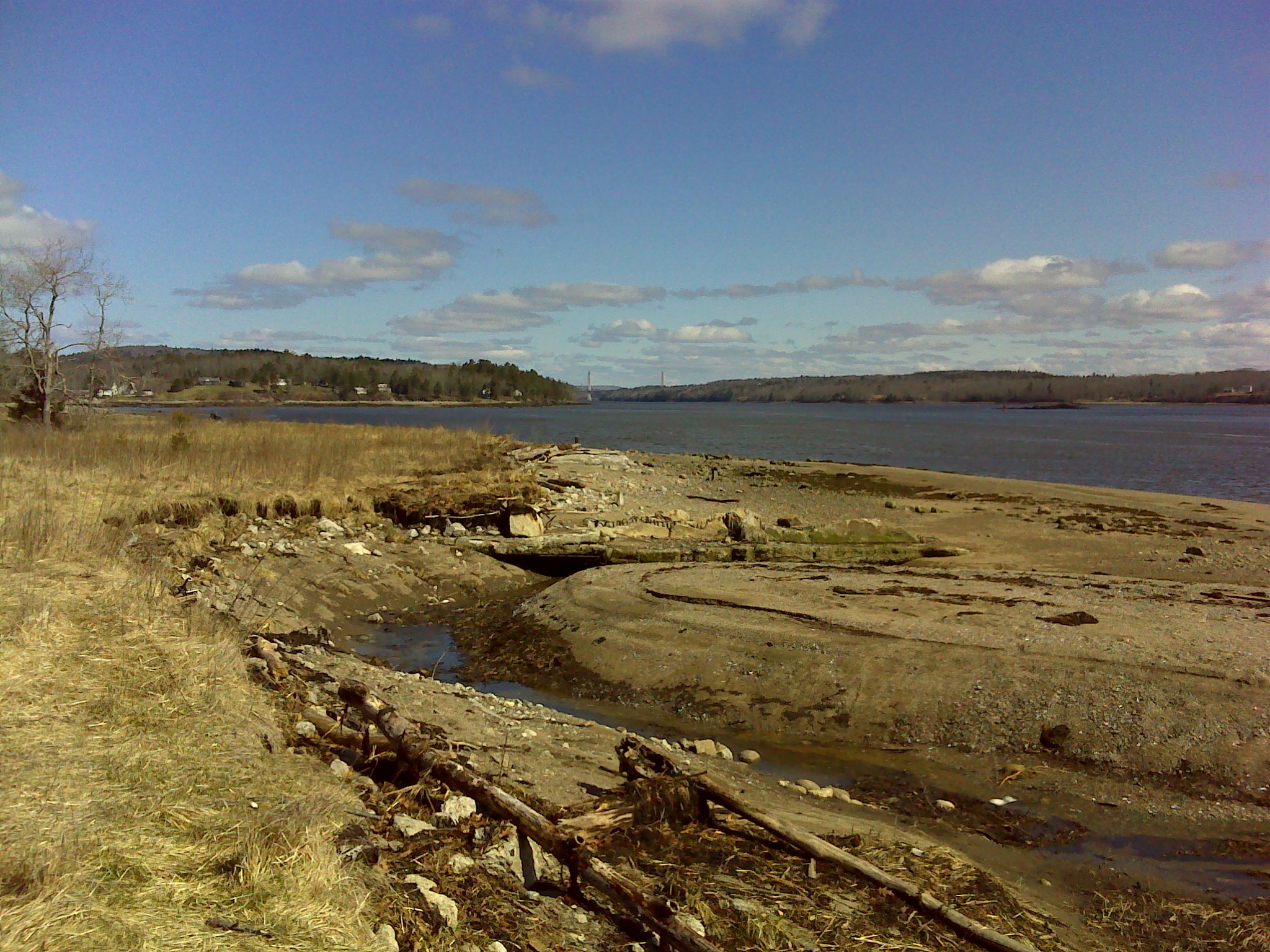
On the beach itself, the pilings of an old wharf march out into the water. The tide is out. The exposed beach is gravel and debris—broken logs and wisps of dried seaweed. It's not a pretty beach. No expanse of soft sand. Sandy Point is a gritty Maine beach.

A lot of history happened here. Even before the Penobscots made summer camp here, Paleolithic peoples fished and gathered shellfish here. It was a bountiful spot. And the sea breezes kept the black flies other biting insects at bay. Across the bay near Castine, an important battle in the Revolutionary War took place. Through the colonial period the area changed hands several times. The French, British, and American colonists all saw the value of Penobscot Bay.
Later, sailing ships and steamboats plied these waters delivering goods and tourists and leaving with Maine's forests cut into fragrant lumber. The remains of the wharf are a reminder of how recently our world shifted away from the water to the land.
Atop one of the pilings at the water's edge, sits an osprey. Its white neck and chest stand out against the blue sky and the weathered gray wood. As I crunch down the beach below the tide line, it hunches down as if to disappear. It must be protecting its perch for a nesting site. I scan the sky, but see no mate. Maybe, the other bird is out in the bay fishing.
Upstream, the Penobscot River squeezes between mainland bluffs and Verona Island. The towers of the Penobscot Narrows Bridge rise above the forest, shining like lighthouse beacons.
