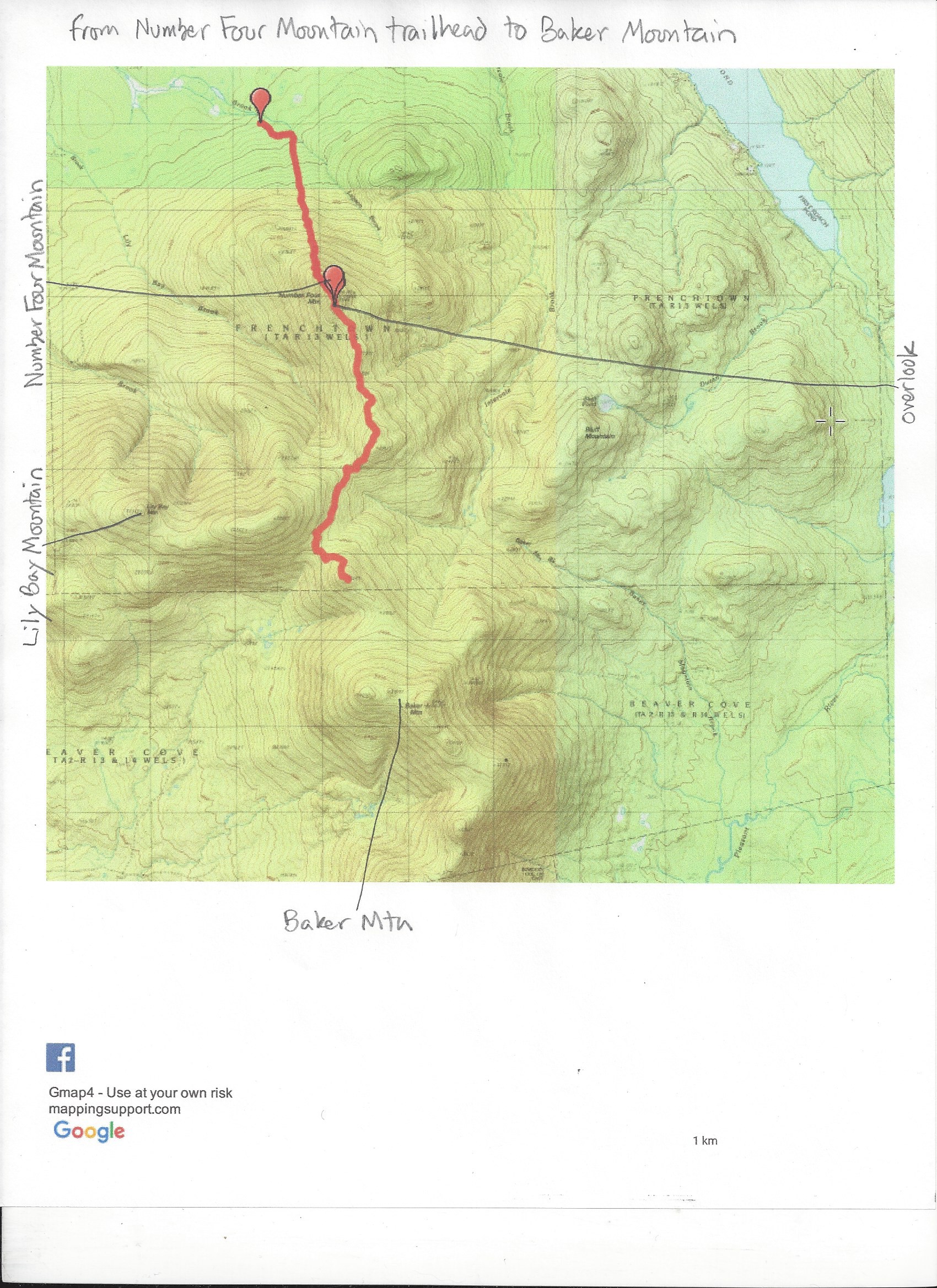
Today I hiked up Number Four Mountain. It's the only of the Lily Bay Mountains that is trailed. The AMC is working on changing that. They are in the process of cutting a trail from the top of Number Four over Baker Mountain and on to the trail network centered around the Lyford Ponds area.
Before I describe the hike, I want to update the driving directions to the Number Four Mountain trailhead. You can follow the directions in Best Easy Day HIkes Greenville, Maine or drive north of the Lily Bay Road from the blinking light in Greenville. After 13.4 miles turn right onto a well-used logging road. Drive 1.8 miles. Turn left onto Meadow Brook Road (there's no sign). Drive 2.2 miles with views of Number Four Mountain along the way. The trailhead is on the right (several signs); parking is across a bridge 0.1 miles farther. This route is quicker than the one I put in the guide. The road is pretty good, although there are a few places that are badly rutted. I made it easily in my Honda C-RV.
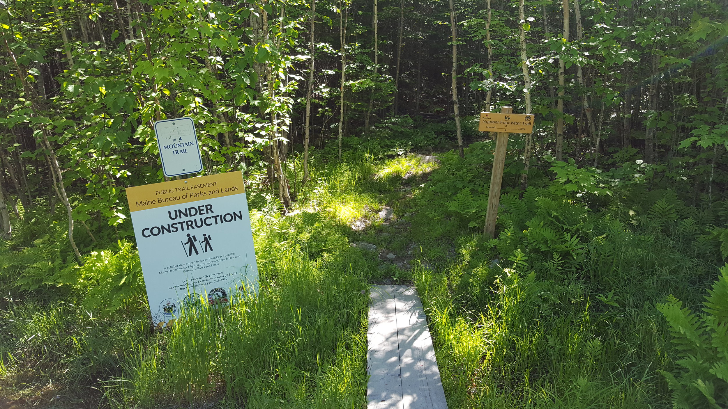
The hike up Number Four Mountain is easier than it used to be. Two years ago a whole bunch of switchbacks were added to the old fire warden's trail, which went straight up the side of the mountain. There are lots of wildflowers along the trail, including a large patch of jack-in-the-pulpits next to the long board walk a half mile into the hike. The summit ridge sports lots of blue bead lilies and bunchberries. Trillium are common. Along the summit ridge, an unmarked trail on the left (north) leads to a great view of Katahdin.
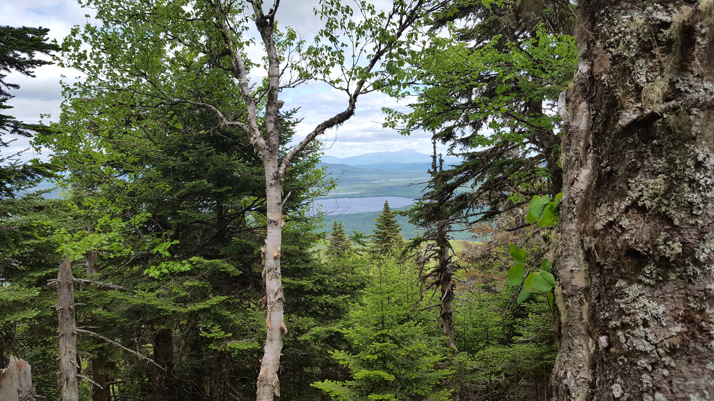
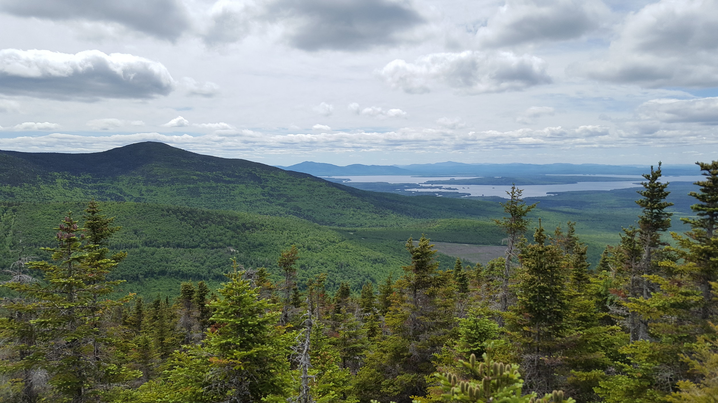
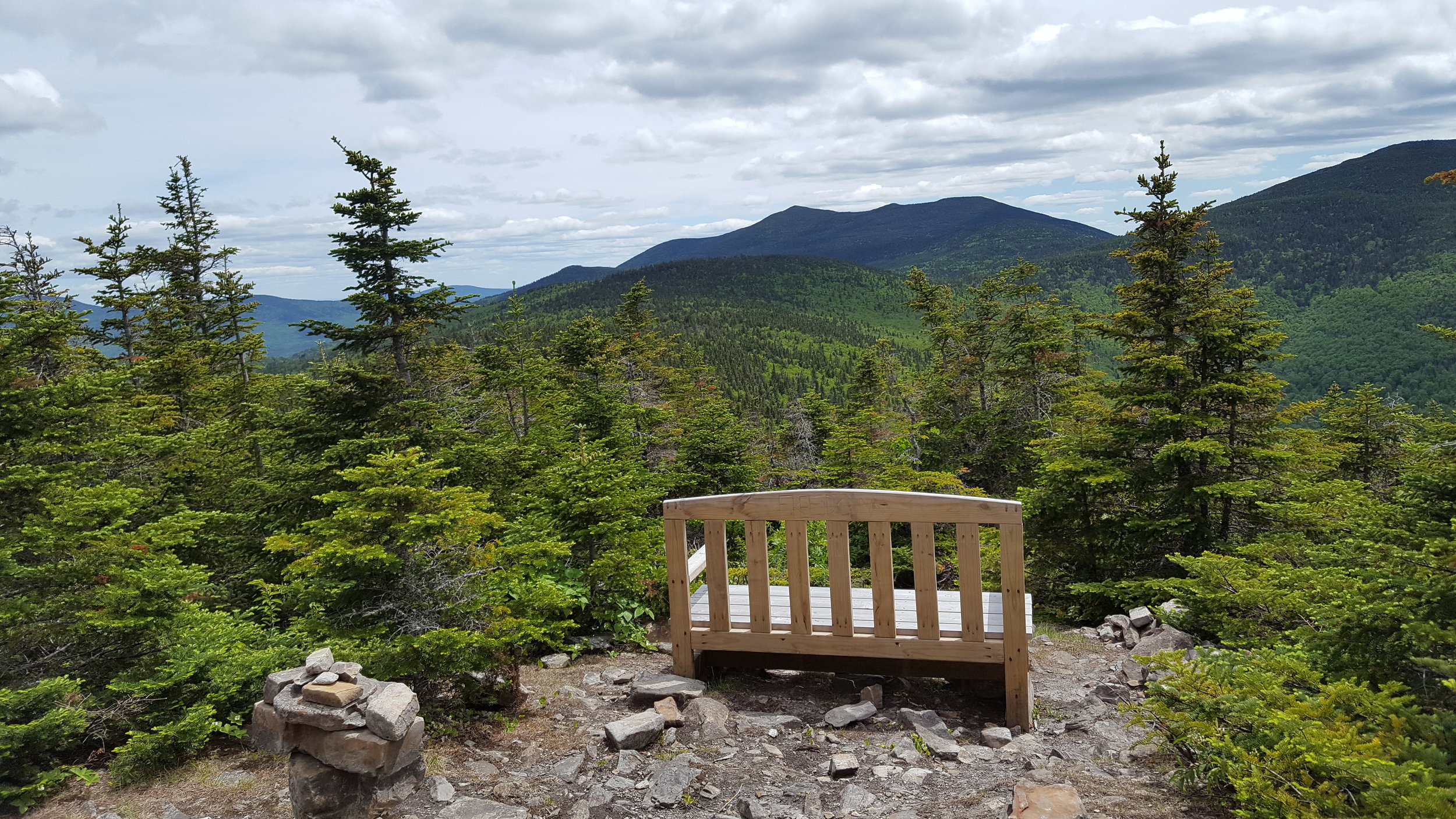
Just past the summit, there's an overlook with a bench. There are great views of the Lily Bay Mountains, Moosehead Lake, and the mountains across the lake. It's the view that's on the cover of BEDH Greenville.
From the overlook, the trail descends and crosses the ridge that connects Number Four and Baker Mountains. The first 1.5 miles are blazed, finished trail. After that, the next mile is cut, but not yet blazed. There are lots of blow downs to navigate, but the hike is relatively easy. The trail crosses a snowmobile trail and begins to climb. Pretty soon the trail ends. Today the AMC trail crew of four was cutting the trail up the slope. The encouraged me to be the first to follow the new trail route. It's flagged another half mile over a knob on the shoulder of Baker Mountain with some semi-views to the AMC property line.

The crew told me that the AMC is waiting for the permit to continue the trail over Baker Mountain and on to Little Lyford Pond camps. I can't wait. The route is remote, passing through beautiful mixed forest with lots of ferns and wildflowers. I'm told there are ledges near baker's summit with spectacular views. I hope this trail is the beginning of the realization of Chris Keene's dream of a trail that circles Moosehead Lake. Now that would be a hike!
