This is a bonus hike for my guide Best Easy Day Hikes Portland.

Start: From the trailhead at the back of the parking area
Distance: 2.8 miles lollipop
Approximate hiking time: 1-2 hours
Difficulty: Easy
Seasons: Beautiful in every season
Trail surface: Woodland path
Land Status: Bonyun Preserve of the Kennebec Estuary Land Trust
Nearest Town:Westport Island. Services in Wiscasset
Other users: None
Water availability: None
Canine compatibility: Dogs are not allowed in Bonyun Preserve.
Fees and permits: No fees or permits are required.
Maps: Delorme's The Maine Atlas and Gazetteer map 7
Trail Contact: Kennebec Estuary Land Trust, www.kennebecestuary.org, 442-8400
Finding the trailhead: From the junction of US1 and ME 144 between Wiscasset and Woolrich, drive south on ME 144 onto Westport Island. Ten miles from US 1 turn left onto West Shore Road. (You will have passed the other end of West Shore Road at about mile 6.) The trailhead is a quarter of a mile down West Shore Road on the left. Trailhead GPS: N43° 52.602' W69° 43.123'.
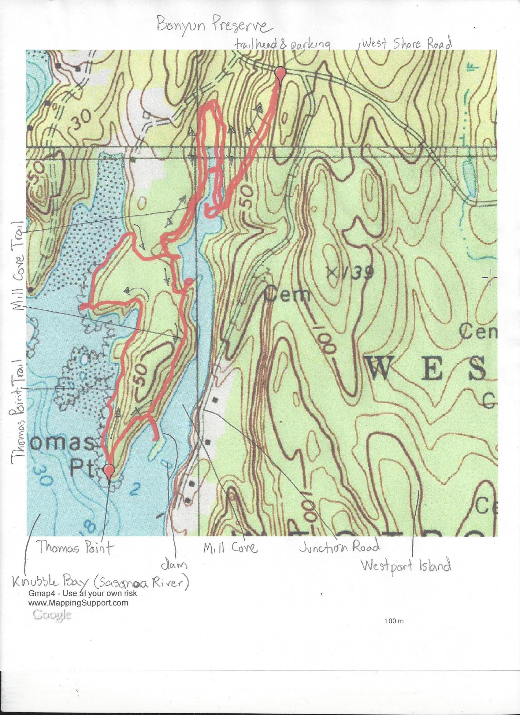
The Bonyun Preserve trails follow the west shore of Mill Cove Creek to Thomas Point. There are fine views of Knubble Bay and the jumble of islands in it. The hike passes an old mill dam across Mill Cove (thus its name). There's a great information sign about the history of the area there.

Miles and Directions:
0.0 Trailhead at the back of the parking area, next to the information sign.
0.3 Reach Mill Cove Creek
0.5 Follow the east shore of the creek to its head.
1.2 Follow the west shore of the creek/cove through piney woods to the old mill dam.
1.4 Reach Thomas Point, a rocky knubble covered with twisted pines. Great views of the surrounding waters, including the mouth of Robinhood Cove on Georgetown Island.
1.9 Leave the shore.
2.8 Arrive back at the trailhead.


Along the hike, you're likely to see various gulls and waterbirds--and maybe even an eagle or osprey.