
Mount Megunticook’s wooded summit (my index finger making a cameo). The best thing about this hike is the journey—not the destination
There are several ways to reach Ocean Lookout and the summit of Mount Megunticook. In Best Easy Day Hikes Camden, I described the classic route. Here’s a less traveled alternative that takes in some of the best scenery in Camden Hills State Park.

0.0 Start at the winter parking area at the main entrance to Camden Hills State Park (off US1). Walk up the park road and through the campground.
0.2 Bear left onto the Multi-use trail at the back of the campground at the sign.
0.3 Turn left onto Mount Megunticook Trail at the sign.
0.9 Climb steadily through a hardwood forest dominated by large oaks. Turn left onto Adams Lookout Trail.
1.2 Climb gently and pass Adams Lookout. Actually, this isn’t the actual lookout—it’s 0.1 miles down a no-longer maintained trail. This is your first real view of the hike.

Emma crossing the open area near Adam’s Lookout
1.3 Climb steadily to the spine of the ridge. Ocean Lookout is a steep 0.2 miles to the right. You want to go straight onto Tableland Trail.
1.4 Descend steeply onto the Tableland. Turn right onto Jack Williams Trail.
3.0 The trail follows the base of the cliffs northwest, descending gently. The best time to hike this section is in the spring after the snow is mostly gone but before the trees have leafed out. You get the clearest views of the cliffs and there are several seasonal waterfalls where streams tumble down clefts in the rock.
Several places you’ll feel like you’re bearing right and beginning to climb before you actually do. After a short, steady climb (past a seasonal waterfall), you reach Ridge Trail. Turn right.

The cliffs below Ocean Lookout

Cliffs beneath Mount Megunticook’s summit
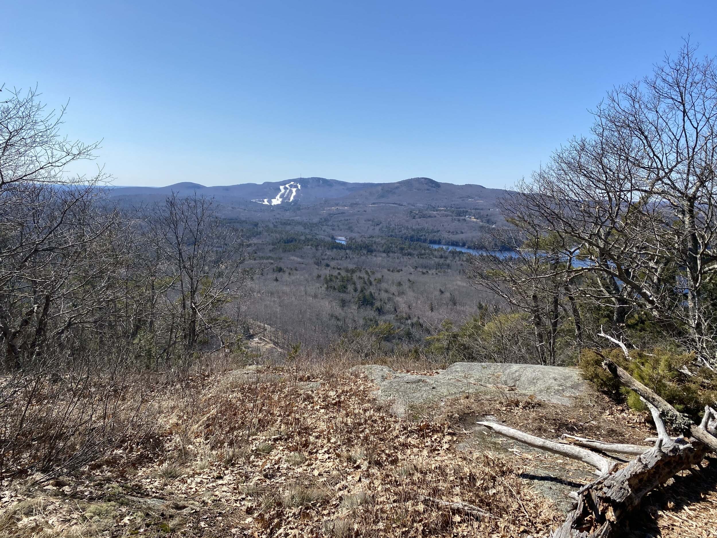
Ragged Mountain (with ski slope) and Bald Mountain (high round hump to the right) from an overlook along Jack Williams Trail
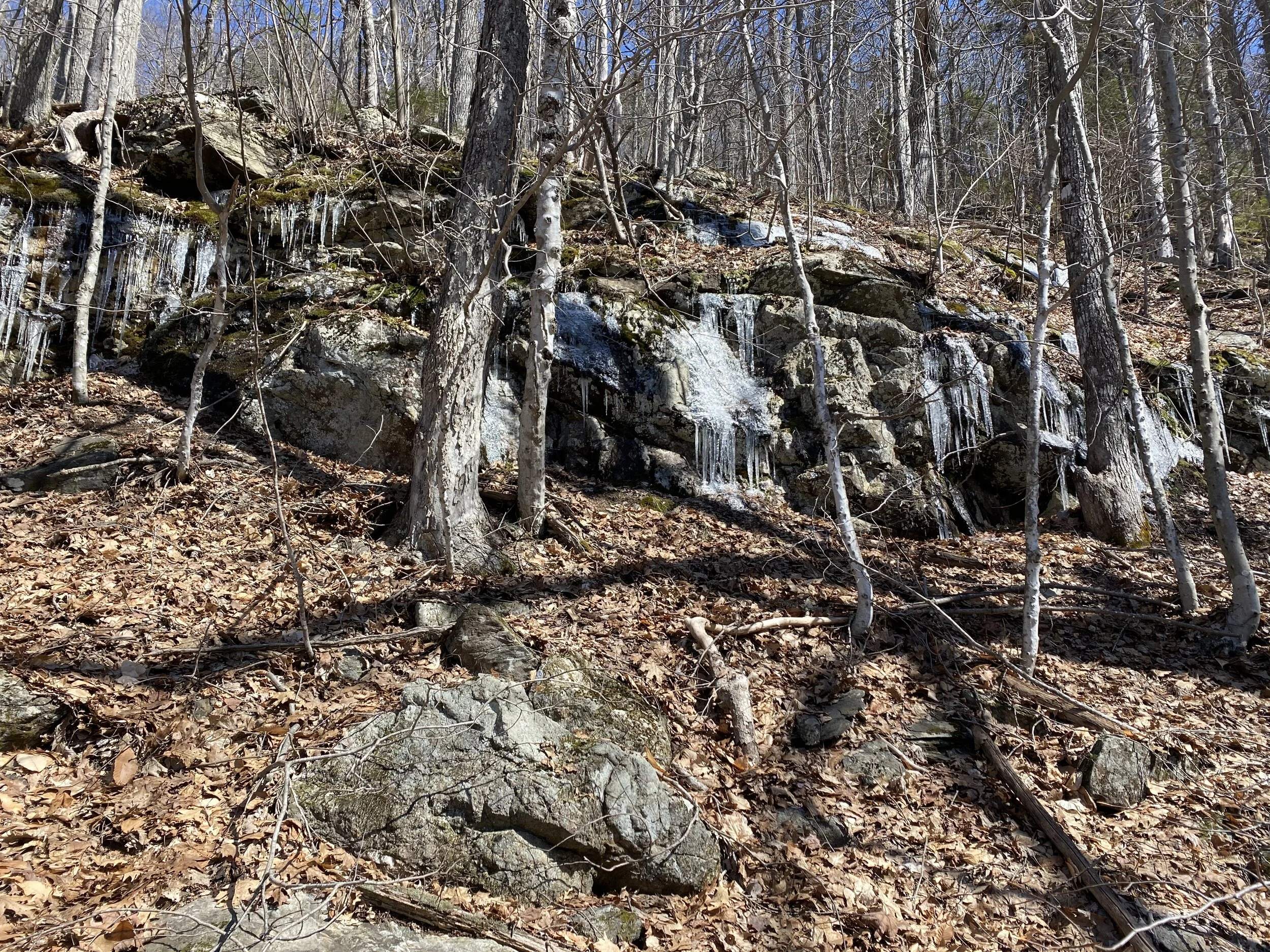
Ice along the climb to Ridge Trail
3.3 Climb steadily through hemlock forest. The trail is rocks and roots and a burbling brook. This section is one of the last to be ice free in the whole state park. Pass Zeke’s Trail. Zeke’s Lookout is 0.5 miles each way if you want to take a detour to see a fine view inland.

Along Ridge Trail, climbing to the top of the ridge
4.2 The trail rollercoasters along the top of the ridge. You get several good views southwest of Ragged Mountain and the coast. The forest atop the ridge is mostly oak with evergreens where the bedrock is right at the surface. The bedrock is varied and interesting. There’s one section where the trail crosses a smooth fin of rock like a frozen ocean swell.
After a short, steep climb, reach the wooded summit of Mount Megunticook. Just beyond the summit, pass Slope Trail.

Henry enjoys the view from along Ridge Trail

Atop a frozen ocean swell
4.6 Descend gently from the summit through evergreens. This section of the hike is a great place to see lady slipper orchids in late spring. Reach Ocean Lookout. Here you have an expansive view of Camden and the coast from atop the cliffs.

Approaching Ocean Lookout
To complete the hike, turn left onto Mount Megunticook Trail.
5.1 Descend steadily through the woods to the junction with Adams Lookout Trail. Go straight, staying on Mount Megunticook Trail and retrace your steps back to the parking area.
6.0 Arrive back at the parking area. NOTE: in summer there’s parking area 0.1 miles up the Mount Battie Road with a side trail to it. Parking in this lot shortens the hike by a few tenths of a mile and means you don’t have to walk through the campground.