
The trailhead on a November day
The Hike to Wadleigh Mountain is part of the new Great Circle Trail in the Nahmakanta Public Reserved Land. The hike starts from the Third Mushquash Pond Trailhead along the Nahmakanta Road (the road that runs between Jo Mary Road and Second Roach Pond). It’s a 7.3 miles out and back hike through some gorgeous woods to a cliff top overlook.

Fern-covered boulder among the evergreens
To get to the trailhead, drive north on ME11 out of Brownville. Drive 15.7 miles. Turn left onto Jo Mary Road (at the sign for Jo Mary Campground). Drive 0.1 mile. Stop and pay the entrance fee. Continue on Jo Mary Road. Drive another 6.0 miles. Turn right, staying on Jo Mary Road. Drive 16.2 miles. Pass the parking for the Turtle Ridge and Tumbledown Dick Trailheads. Continue another 3.9 miles. Turn left at the intersection onto Nahmakanta Road (that leads eventually to Second Roach Pond). Drive 1.0 mile uphill. Turn right into the parking area just past a giant boulder sitting beside the road. The trailhead is at the north end of the parking area marked with two signs. (Across the road is the continuation of the Great Circle Trail that connects to the Turtle Ridge loop between Sing Sing Pond and Turtle Ridge.) From the parking area, you have a fine view of Katahdin.
The distance on the signs at the trailhead are not accurate. It’s 2.3 miles to the campsite and 3.7 miles to the summit of Wadleigh Mountain.
0.0 Third Musquash Pond Trailhead (in some places on the Great Circle Trail, this trailhead is called Katahdin View).
1.5 The trail is new, so there really isn’t much of a footbed yet. The trail is very well blazed, so you wander among bounders and mossy rocks through second growth hardwoods from blaze to blaze. Periodically, the trail passes through a ledgy section where granite errupts to the surface and the hardwoods give way to evergreens, especially hemlocks. I dubbed one of these granite erruptions The Whale becaue it looks like a great blue whale breaching the surface. When you hike past it, you’ll recognize it immediately.
The trail reaches Third Musquash Pond’s outlet stream. The trail makes a hard left where the brook crashes through a series of granite ledges cracked into an ill-fitting wall.

Looking up the brook toward where the trail reaches the granite ledges
The trail follows along the south side of the brook through moss-covered boulders, then bears right and crosses the brook on a small bridge.

The trail continues following the brook past a narrow canyon and other features.

Looking down the small waterfall at the head of the narrow canyon
2.2 The trail climbs away from the brook where it flows out of a marshy swale. On your right, is a recently cut area. Several skidder trails reach down to the trail. The trail drops back down to the brook, which is now the narrow, marshy east end of Third Musquash Pond. A short, unmarked but blazed trail leads 100 feet to the water. Look for beaver, wood ducks, and moose here.
2.3 The trail passes a second blazed but unmarked side trail. This one leads to the campsite on the shore of the pond. You have a nice view of the pond and Farrar Mountain in the distance.
2.5 The trail passes a third side trail that leads out to the pond. From the marshy shore, you can look to the hard right and see the ridge of Wadleigh Mountain, including the ledges where the overlooks are.

Third Musquash Pond (with the shoulder of Wadleigh Mountain to the right)
3.5 The trail begins to climb gently away from Third Musquash Pond. As you near the ridge of Wadleigh Mountain, the trail becomes steeper. You switchback up the rocky slope, following a cleft in the ridge. Near the top, the trail turns left and slabs around the ridge to a blazed side trail out to the ledges. Make sure when walking out onto the ledges that you don’t stop at the first viewpoint. The trail continues through some trees to the most open overlook (look for flagging in the trees).

Looking west across the lower ledges
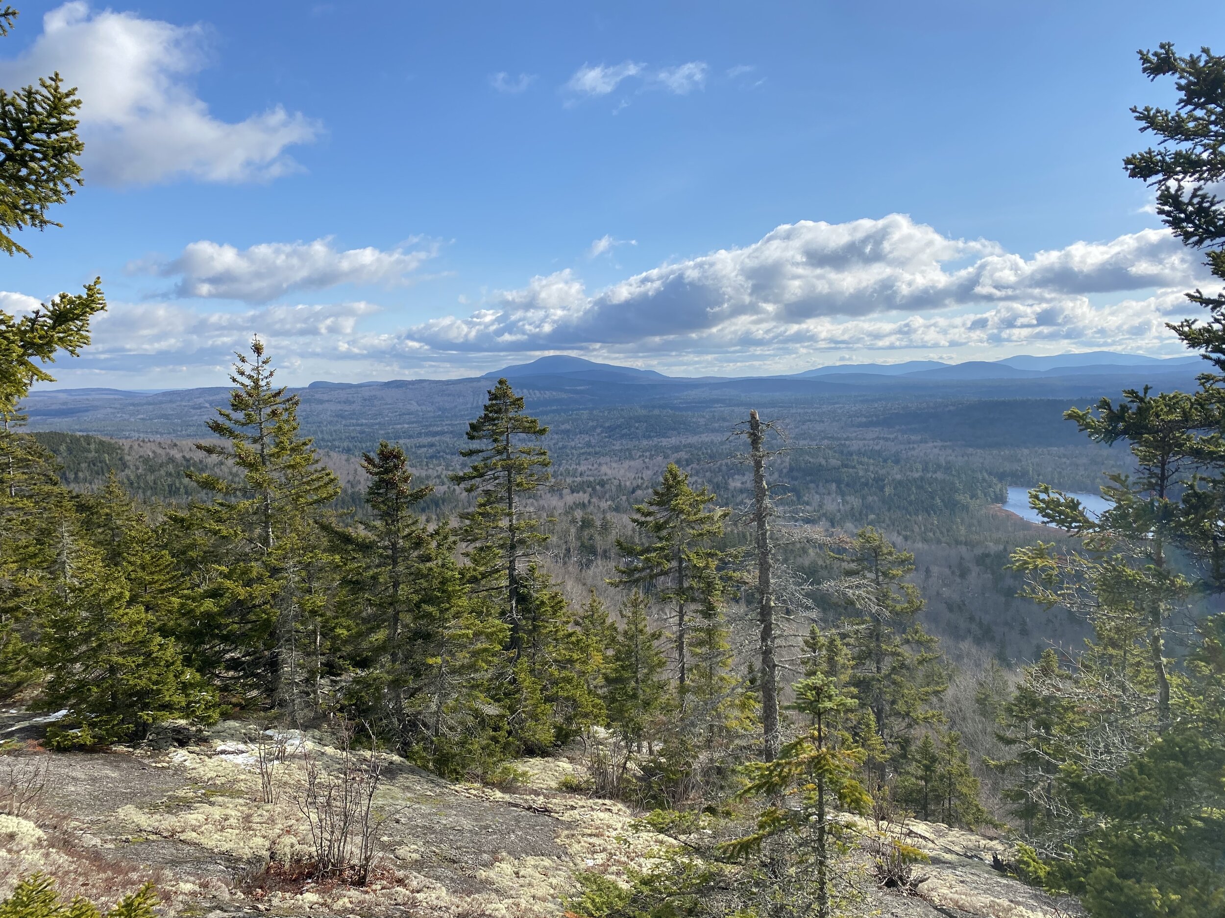
Jo Mary Mountain and Third Musquash Pond from the ledges
From the side trail to the lower overlook, Bear right and climb steeply 200 feet to the side trail to the upper overlook.
3.7 Past the overlooks, the trail wanders from ledge to ledge, climbing in fits and start to reach the wooded summit. Until recently there was a tower on the summit. You can still see the plates and bolts where it was attached to granite.

Wadleigh Mountain’s summit
The trail makes a hard left off the summit and continues all the way to the Appalachian Trail at Crescent Pond, passing Wadleigh Pond, Pollywog Pond, and the Pollywog Falls along the way. But that’s another hike. For this one, just retrace your steps back to the Third Musquash Pond Trailhead.

Clouds refected in Third Musquash Pond as seen from the campsite