
Tunk Mountain seen from Spring River Lake
Tunk Mountain rises north of ME182 in the Donnell Pond reserved lands in an unorganized township between Franklin and Cherryfield. (For full directions and description of the main trail see Hiking Maine.) It’s a popular hike because of the expansive views from the rocky summit ridge. The hike is just challenging enough to make you feel like you really earned those views of the mountains of Acadia and the Downeast coast.

Looking toward the coast from near the summit
If you’re like me, you’ve climbed Tunk Mountain and wondered what else there was to explore. Are there waterfalls on the mountain? How do you get to Tilden Pond (that you can see from the mountain)? Where exactly is the actual summit? Am I missing anything by just following the trails?
So, I decided to remap Tunk Mountain and find the answers to my questions.

The complete map of official and unofficial trails on and around Tunk Mountain
I’m always on the lookout for waterfalls. Both because I wrote a guide to Maine waterfalls and am always thinking of how to make it better. And, well, I like waterfalls.
The trail system on Tunk Mountain passes two seasonal waterfalls. The best time to see them is beginning when it warms up enough to start melting the ice and snow. By the time the snow is gone, both waterfalls are little more than trickles. The easiest waterfall to find is on a small brook the trail follows above Mud Pond. Almost exactly 1.0 mile from the trailhead, the trail makes a right turn away from the brook. If you continue straight along the stream, there’s a small waterfall (about three feet) right away and a nice drop down a sheer rock face in about 200 feet. Above the rockface is a small boggy area that the water flows out of.
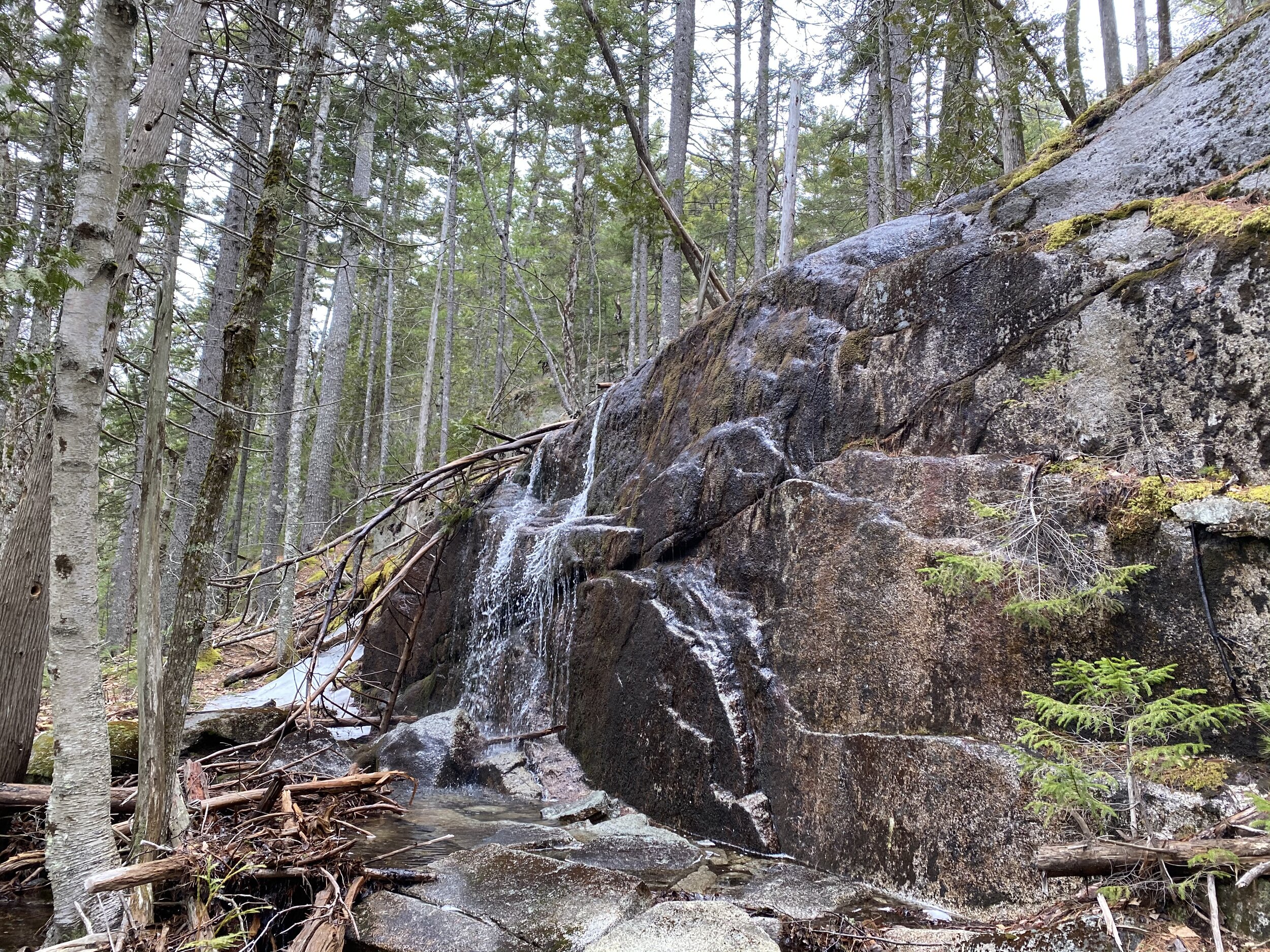
The second waterfall is accessible from the Hidden Ponds trail. To get to it, hike from the trailhead 0.7 miles. Turn right onto the Hidden Ponds trail (for some reason this end of the loop is unsigned). Hike 0.8 miles past Salmon Pond and on to the clifftop overlook of Little Long Pond. Just before you got to the overlook, you crossed Salmon Brook on bog boards. The waterfall is where this brook drops to the level of Little Long Pond. To get there, follow the unmarked but obvious trail along the cliff to the right (south) of the overlook. Stay high. It looks like you should downclimb. Don’t. Hike a few hundred feet farther and there’s an easier place to climb down. When you reach the level of the pond. You’ll see and hear the waterfall dropping off the rock face into a braided stream that feeds into the pond.

Salmon Brook Falls when it’s still mostly frozen
From the waterfall, you can make your way across the stream on the numerous mossy boulders and climb the rough trail to the top of the cliffs on the east side of the cove. The cliffs here are more open and expansive than on the west side where Hidden Ponds Trail is—there the clifftops are wooded. There’s also a trail that drops down to the shore of Little Long Pond where you have a nice view of Tunk Mountain and the long, ledge-studded ridge east of the mountain. (This ridge is untrailed. Over the summer I plan to bushwack out it to check out the views.)

Tunk Mountain hiding in a cloud from the shore of Little Long Pond

An enlargement of the map that shows the location of the two waterfalls
From Momument Vista and the nearby ledges, you get great views of the lakes and ponds south and east of the mountain: Little Long Pond, Salmon Pond, Tilden Pond, and Spring River Lake (you can’t see Mud Pond—it’s tucked in a cleft below you out of sight). The Tunk Mountain trail skirts the west end of Salmon Pond and the Hidden Ponds Trail loops around Salmon Pond and visits Little Long Pond. But none of the official trails go to Tilden Pond.
In fact, there is a no longer maintained trail to Tilden Pond. From the trailhead parking area, hike 0.5 miles to the first (unsigned) intersection with Hidden Ponds Trail. Turn right on that trail and hike 0.1 miles on the sidehill along Salmon Pond. You reach a spot where the trail bears left and descends to the shore of Salmon Pond. At the bend, there’s a small sign on a tree: End of Maintained Trail.

Sure enough, a trail leaves Hidden Pond Trail at the sign. Bear right off Hidden Ponds Trail and follow this obvious trail. The Tilden Pond Trail is relatively flat and in good shape. It’s 0.7 miles from Hidden Pond Trail to the shore of Tilden Pond. From the south shore of the pond, you have fine views of Tunk Mountain and its long east ridge.

the view of Tunk Mountain from Tilden Pond on a cloudy day
Tunk Mountain Trail crossed the summit ridge from the south-facing ledges to the north ledges, but never crosses the summit. There is a trail to the summit, though. It’s just not an official trail and therefore not signed or blazed. To find it, climb up the ledges on Tunk Mountain Trail. The trail leaves the ledges and enters the woods as it’s crossing the summit ridge. Almost as soon as you enter the woods, look for a trail on the left (west). Step down off the rock and follow this trail. It heads through the woods and crosses a granite ledge in the woods. Descend off the ledge. There’s flagging in the trees all along this trail. Off the ledge, the trail forks. Bear right and follow the obvious and flagged trail. The trail skirts around the north side of a large mass of bedrock as high as the forest. Around this formation the trail climbs along its west end to a flat. A heads left up this formation. It’s worth checking out, but it’s not the summit and has no views. Instead, turn right and continue to follow the Summit Trail. Again, you skirt around the north side of a large rock formation. This is the summit. The trail comes out on a large open granite area. To your right is a small building bolted to the bedrock. To your left, the granite rises in a gentle curve to the summit. There’s a USGS survey marker imbedded in the rock at the summit. It’s 0.2 miles from Tunk Mountain Trail to the summit.
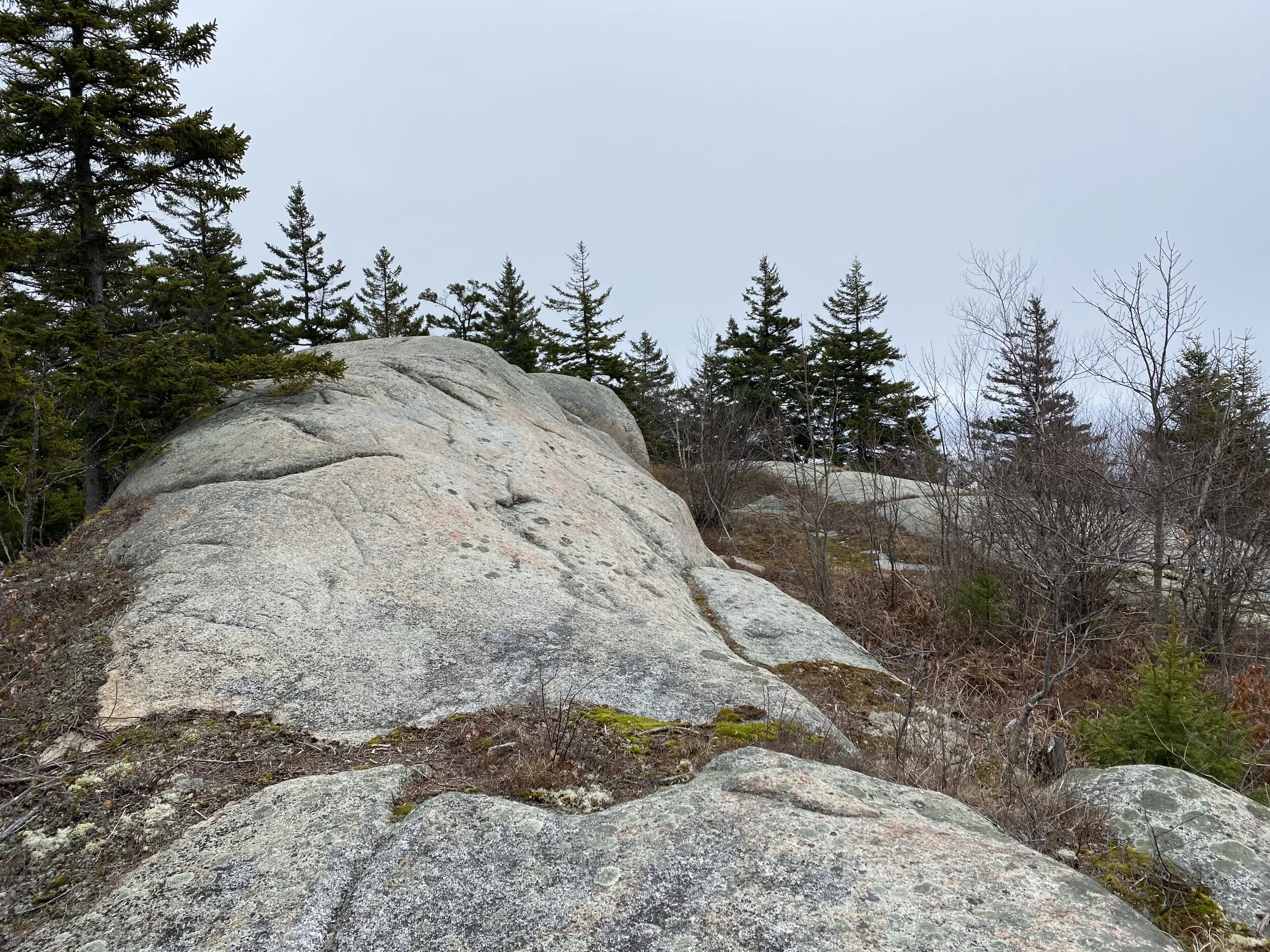
The summit

Looking south from the summit on a very cloudy day
After enjoying the summit, walk over to the ledge the building is bolted to. You have a good view to the north. If you look west, you’ll see that the ledge drops straight down to the woods. On a tree against the ledge is a piece of flagging. Climb down off the ledge. You’ll see that the trail continues. Follow it a few hundred feet to a large, open ledge that drops way down. You have a great view here. You’re far enough west that Caribou and Catherine Mountains don’t block your view of MDI. You can also see Mud Pond below you.
The trail actually descends all the way off the mountain to Myrick Pond Road. But your car is at the Tunk Mountain Trailhead, so eat a snack on the steep rock and then head back the way you came.

The clouds begin to lift, revealing the coast. Notice Mud Pond and Salmon Pond below the cliffs

Looking west from the ledges near the summit. On a clear day, you can see Blue Hill and the Camden Hills
Two further bits of exploring to mention. First, especially in the winter, you' may notice Spring River Lake east of the trail at about the 0.3 mile mark (near the low, wet area you cross on bog boards). There’s a marked bushwack to the shore. Where the trail turns left at the first giant boulder, you’ll notice some flagging in a tree south of the boulder. More flagging and large blazes lead east to the lake. There’s no trail and the ground is mostly very uneven, moss-covered boulders. The blazes are actually a property line. To the left is state land; to the right posted private property. You can make it to the shore of the lake without trespassing.
From the shore of Tilden Pond, you’ll notice several open ledges on Tunk Mountain’s long east ridge. I plan to bushwack around Tilden Pond and up this ridge. I would come out at or just above Monument Vista. If it looks like a good route, I plan to suggest to the powers that be that they make it a maintained trail. Stay tuned!

Sometimes it is all fun and games